
 Cart
CartHistorical Street Maps
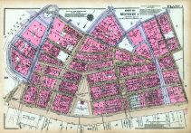
Historic street maps offer a unique view of the development of the nation. As you view the change in the road maps of the country, you can chart the change in people's transportation and style. The old maps of roads through the country show how people generally stayed close to their hometown. As the nation grew, so did the road system. These growth and changes can be seen by examining the street maps of America.
Search For Historical Street Maps of Your CityCity Street Maps
Many cities in America have undergone a drastic transformation in the nation's short history. With the growth and expansion these cities have experienced, the road system is in constant need of expansion and growth. Comparing road maps from the present to ones from just twenty years ago tells the story of how quickly things change.
Many cities have street maps from colonial time available. These historic street maps show how simple the street systems were at that time. Most cities had short, easy to navigate streets through the city. Since there wasn't the traffic on the roads back then, there was often only one road into and out of town. All visitors and residents had to enter the city via that one road. As America grew, so did the need for a better road system.
With the invention of the automobile, the street system became more important than ever. The new autos made the country more accessible, but the street system had to be modified yet again. The increased demand for travel forced the addition of more streets and roads.
Historical Significance
When researching street maps in American history, you see the relationship between growth and expansion and the complexity of street systems. As the nation became more prosperous and spread out, out road systems became more complex and spread out. The historical record of street maps through history have documented the growth and change that America experienced.
Many times, towns and cities are unrecognizable in the old street maps compared to the modern day street system. These historic maps offer a view into what life was like for city residence in previous centuries. It is interesting to see what historic streets have remained unchanged over time and which ones have been renamed and rerouted.
When researching the history of a town or area, old street maps offer a significant source of information concerning the makeup of the town. A lot of information can be gleamed from analyzing the road system of a settlement. You can tell where the most populated areas are and where the central commerce location was. These old maps help to trace the original names of streets that get renamed over time in someone's memory. When researching gamily history, street maps can provide information as to where your family's home was located.
Historic maps offer a glimpse into the past showing what life was like in days past. Including maps as resources when researching for information about a location or population, you can gather a lot of information in one place. historical street maps offer valuable information about a region's transportation system that in turn provides information about the way of life in that time period.