Michigan Historical Maps and Atlases
The state of Michigan collection contains 1,389 atlases spanning 311 years of growth and development (1696 through 2007).
Within the atlases are 73,952 historical maps, illustrations, and histories many of which contain family names ideal for genealogical research. Others are rare antique maps, part of the collection by an exclusive arrangement with the Osher Map Library. The state of Michigan has 16 of these antiquarian maps dating back as early as 1696.
|
Displaying 1- 50 of 373 in total
|
Next >> |
Click on a column header to sort table.
|
Name |
Attributes |
Quality |
Publisher |
State |
Date |
|
Name |
Atlas |
Attributes |
Publisher |
Date |
Collection |
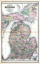 |
Michigan |
United States 1885 Atlas of Ce... |
 |
H. R. Page & Co. |
1885 |
HMW |
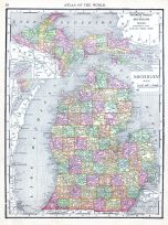 |
Michigan |
World Atlas 1913 |
|
Rand McNally and Com... |
1913 |
HMW |
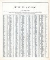 |
Michigan - Guide 1 |
United States 1885 Atlas of Ce... |
|
H. R. Page & Co. |
1885 |
HMW |
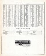 |
Michigan - Guide 2 |
United States 1885 Atlas of Ce... |
|
H. R. Page & Co. |
1885 |
HMW |
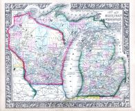 |
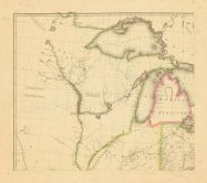
Michigan and Wisconsin |
World Atlas 1864 Mitchells New... |
|
S. Augustus Mitchell |
1864 |
HMW |
 |
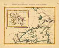
Map - Page 1 |
Partie Occidentale de la Nouve... |
|
Bellin, Jacques Nico... |
1755 |
OML |
|
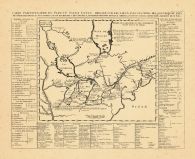 |
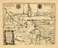
Map - Page 1 - CARTE PARTICULI... |
CARTE PARTICULIERE DU FLEUVE S... |
|
CHATELAIN, HENRI A. |
1719 |
OML |
|
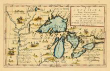 |
Map - Page 1 - LA LOVISIANA,Pa... |
LA LOVISIANA,Parte Settentrion... |
|
CORONELLI, VICENZO M... |
1696 |
OML |
|
 |
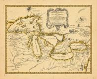
Map - Page 1 - LES LACS DU CAN... |
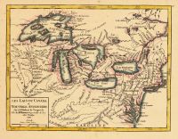
LES LACS DU CANADA et NOUVELLE... |
|
VAUGONDY, ROBERT de |
1749 |
OML |
|
 |
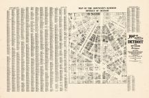
Map - Page 1 - Map of the city... |
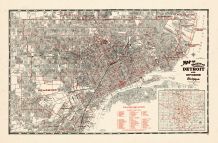
Map of the city of Detroit and... |
|
Sauer Bros. |
1943 |
OML |
|
 |
Map - Page 1 - NOUVELLE CARTE ... |
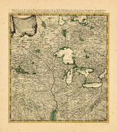
NOUVELLE CARTE PARTICULIERE DE... |
|
POPPLE, HENRY / COVE... |
1741 |
OML |
|
 |
Map - Page 1 - PARTIE OCCIDENT... |
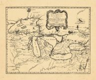
PARTIE OCCIDENTALE/de la/NOUVE... |
|
BELLIN, JACQUES NICO... |
1755 |
OML |
|
 |
Map - Page 1 - UNITED STATES o... |
UNITED STATES of Nth. AMERICA/... |
|
TARDIEU, P.F. [AFTER... |
1812 |
OML |
|
 |
Map - Page 2 - LE COLONIE UNIT... |
LE COLONIE UNITE DELL AMERICA ... |
|
MITCHELL, JOHN / ZAT... |
1778 |
OML |
|
 |
Map - Page 2 - Map of the city... |
Map of the city of Detroit and... |
|
Sauer Bros. |
1943 |
OML |
|
 |
Map - Page 4 - Le Cours du/MIS... |
Le Cours du/MISSISIPI,/ou de S... |
|
FER, NICOLAS DE |
1718 |
OML |
|
|
Displaying 1- 50 of 373 in total
|
Next >> |

 Cart
Cart