 |
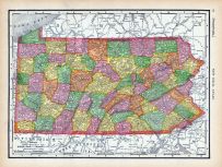
Page 068 - Pennsylvania |
World Atlas 1911c from Minneso... |
|
Rand, McNally and Co... |
1911 |
HMW |
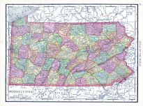 |
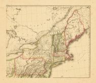
Pennsylvania |
World Atlas 1913 |
|
Rand McNally and Com... |
1913 |
HMW |
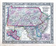 |
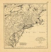
Pennsylvania, New Jersey, Mary... |
World Atlas 1864 Mitchells New... |
 |
S. Augustus Mitchell |
1864 |
HMW |
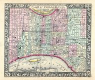 |
Philadelphia |
World Atlas 1864 Mitchells New... |
|
S. Augustus Mitchell |
1864 |
HMW |
 |
Map - Page 1 |
Partie Occidentale de la Nouve... |
|
Bellin, Jacques Nico... |
1755 |
OML |
|
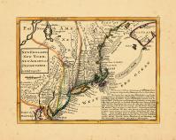 |
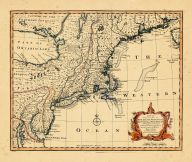
Map - Page 1 |
New England, New York, New Jer... |
|
Moll, Herman |
1729 |
OML |
|
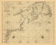 |
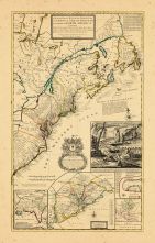
Map - Page 1 - A Chart of the/... |
A Chart of the/Sea Coast of/NE... |
|
THORNTON, JOHN / MOU... |
1713 |
OML |
|
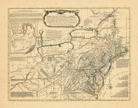 |
Map - Page 1 - A General/MAP o... |
A General/MAP of the/MIDDLE BR... |
|
EVANS, LEWIS / BOWLE... |
1765- |
OML |
|
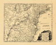 |
Map - Page 1 - A MAP of the/BR... |
A MAP of the/BRITISH/AMERICAN ... |
|
BOWEN, EMANUEL |
1754 |
OML |
|
 |
Map - Page 1 - A NEW AND CORRE... |
A NEW AND CORRECT MAP/OF THE/B... |
|
LAURIE and WHITTLE |
1794 |
OML |
|
 |
Map - Page 1 - A New and/ACCUR... |
A New and/ACCURATE MAP OF/NEW ... |
|
BOWEN, EMANUEL |
1752 |
OML |
|
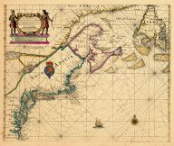 |
Map - Page 1 - A New Chart of ... |
A New Chart of the Sea Coast o... |
|
THORNTON, JOHN |
1685- |
OML |
|
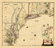 |
Map - Page 1 - A NEW MAP OF NE... |
A NEW MAP OF NEW ENGLAND-NEW Y... |
|
THORNTON, JOHN /ROBE... |
1690- |
OML |
|
 |
Map - Page 1 - A New MAP of/th... |
A New MAP of/the/BRITISH DOMIN... |
|
ANNUAL REGISTER / KI... |
1763 |
OML |
|
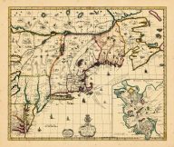 |
Map - Page 1 - A NEW MAPP OF/N... |
A NEW MAPP OF/NEW ENGLAND/and/... |
|
BROWNE, C[HRISTOPHER... |
1714 |
OML |
|
 |
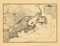
Map - Page 1 - CARTE PARTICULI... |
CARTE PARTICULIERE DU FLEUVE S... |
|
CHATELAIN, HENRI A. |
1719 |
OML |
|
 |
Map - Page 1 - CARTE/DE LA NOU... |
CARTE/DE LA NOUVELLE ANGLETERR... |
|
BELLIN, JACQUES NICO... |
1757 |
OML |
|
 |
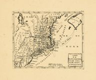
Map - Page 1 - CARTE/de la NOU... |
CARTE/de la NOUVELLE/ANGLETERR... |
|
BERTHOLON, C. |
1799 |
OML |
|
 |
Map - Page 1 - CARTE/de la/Nou... |
CARTE/de la/Nouvelle ANGLETERR... |
|
LAPORTE, JOSEPH de |
1781 |
OML |
|
 |
Map - Page 1 - LA LOVISIANA,Pa... |
LA LOVISIANA,Parte Settentrion... |
|
CORONELLI, VICENZO M... |
1696 |
OML |
|
 |
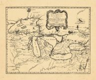
Map - Page 1 - LE CANADA,ou NO... |
LE CANADA,ou NOUVELLE FRANCE/R... |
|
FER, NICOLAS de |
1702 |
OML |
|
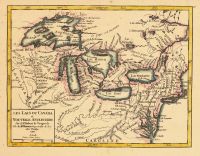 |
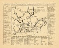
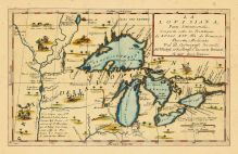
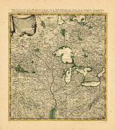
Map - Page 1 - LES LACS DU CAN... |
LES LACS DU CANADA et NOUVELLE... |
|
VAUGONDY, ROBERT de |
1749 |
OML |
|
 |
Map - Page 1 - MAPA GEOGRAFICO... |
MAPA GEOGRAFICO/QUE COMPREHEND... |
|
LOPEZ, TOMAS |
1778 |
OML |
|
 |
Map - Page 1 - MAPPA/GEOGRAPHI... |
MAPPA/GEOGRAPHICA/AMERICAE/SEP... |
|
EULER, LEONHARD von |
1755 |
OML |
|
 |
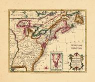
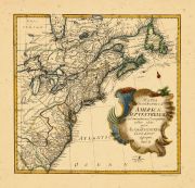
Map - Page 1 - New and Exact M... |
New and Exact MAP of the DOMIN... |
|
MOLL, HERMAN |
1732+ |
OML |
|
 |
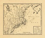
Map - Page 1 - NOUVELLE ANGLET... |
NOUVELLE ANGLETERRE/NLLE. YORK... |
|
VAUGONDY, ROBERT de,... |
1749 |
OML |
|
 |
Map - Page 1 - NOUVELLE CARTE ... |
NOUVELLE CARTE PARTICULIERE DE... |
|
POPPLE, HENRY / COVE... |
1741 |
OML |
|
 |
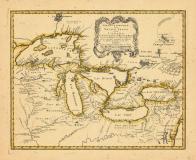
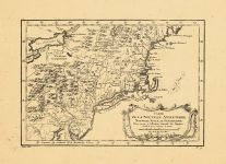
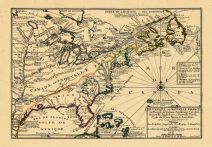
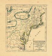
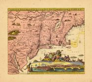
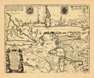
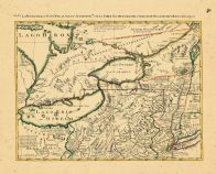
Map - Page 1 - PARTIE OCCIDENT... |
PARTIE OCCIDENTALE/de la/NOUVE... |
|
BELLIN, JACQUES NICO... |
1755 |
OML |
|
 |
Map - Page 1 - TOTIUS NEOBELGI... |
TOTIUS NEOBELGII NOVA ET ACCUR... |
|
ALLARD, HUGO / OTTEN... |
1720- |
OML |
|
 |
Map - Page 1 - UNTITLED CHART ... |
UNTITLED CHART OF THE GULF STR... |
|
LE ROUGE, GEORGES-LO... |
1782- |
OML |
|
 |
Map - Page 2 - A MAP OF THE/UN... |
A MAP OF THE/UNITED STATES/of/... |
|
ARROWSMITH, AARON |
1799 |
OML |
|
 |
Map - Page 2 - UNITED STATES o... |
UNITED STATES of Nth. AMERICA/... |
|
TARDIEU, P.F. [AFTER... |
1812 |
OML |
|
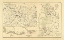 |
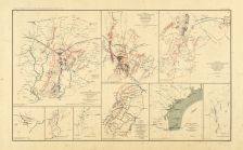
Map - Page 3 - ATLAS/TO ACCOMP... |
ATLAS/TO ACCOMPANY THE OFFICIA... |
|
DAVIS, MAJOR GEORGE ... |
1891 |
OML |
|
 |
Map - Page 4 - ATLAS/TO ACCOMP... |
ATLAS/TO ACCOMPANY THE OFFICIA... |
|
DAVIS, MAJOR GEORGE ... |
1891 |
OML |
|
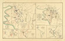 |
Map - Page 4 - ATLAS/TO ACCOMP... |
ATLAS/TO ACCOMPANY THE OFFICIA... |
|
DAVIS, MAJOR GEORGE ... |
1891 |
OML |
|
 |
Map - Page 4 - Le Cours du/MIS... |
Le Cours du/MISSISIPI,/ou de S... |
|
FER, NICOLAS DE |
1718 |
OML |
|
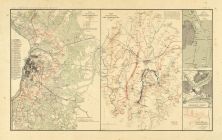 |
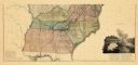
Map - Page 6 - ATLAS/TO ACCOMP... |
ATLAS/TO ACCOMPANY THE OFFICIA... |
|
DAVIS, MAJOR GEORGE ... |
1891 |
OML |
|
 |
Map - Page 6 - LE COLONIE UNIT... |
LE COLONIE UNITE DELL AMERICA ... |
|
MITCHELL, JOHN / ZAT... |
1778 |
OML |
|

 Cart
Cart