Address Search
Results for "Latitude 40.906689, Longitude -85.486158"
View these maps overlayed on top of a modern map. You must be a member and logged in to use this feature.
Purchase a series of maps or images documenting the environmental or land use history of this location.

A variety of printed products can be purchased by clicking on each individual map in the results below.
Click on any of the maps below to view a large, zoomable map.
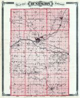 |
Huntington County
Indiana State Atlas 1876
show address on this map
|
Baskin, Forester and Company |
1876 |
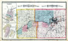 |
Dallas Township, Huntington Township, Warren, Mahon
Huntington County 1879
show address on this map
|
J. H. Beers |
1879 |
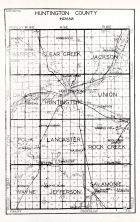 |
Huntington County
Indiana State Atlas 1934
show address on this map
|
W. W. Hixson and Co. |
1934 |
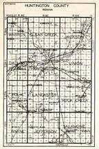 |
Huntington County, Warren, Clear Creek, Jackson, Dallas, Union, Polk, Lancaster, Rock Creek, Wayne, Salamonie, Jefferson
Indiana State Atlas 1950c
show address on this map
|
Hixson Map Company |
1950c |
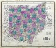 |
Ohio State Map
Wayne County 1873
show address on this map
|
J. A. Caldwell |
1873 |
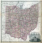 |
Ohio State Map
Hocking County 1876
show address on this map
|
Titus, Simmons & Titus |
1876 |
 |
Indiana State Map
Boone County 1878
show address on this map
|
Kingman Brothers |
1878 |
 |
Indiana State Map
Knox County 1880
show address on this map
|
D. J. Lake & Co. |
1880 |
 |
British America
Wells County 1881
show address on this map
|
H.H. Hardesty |
1881 |
 |
United States Map
Winnebago County and Boone County 1886
show address on this map
|
H. R. Page & Co. |
1886 |
 |
Land Survey of the United States
Cass County 1893
show address on this map
|
D.W. Ensign & Co. |
1893 |
 |
The World Map with Principal Cities of the Old World
Fillmore County 1896
show address on this map
|
Geo. A. Ogle & Co. |
1896 |
 |
United States Map
Genesee County 1899
show address on this map
|
Homer A. Day |
1899 |
 |
World Map
Rooks County 1904 to 1905
show address on this map
|
Geo. A. Ogle & Co. |
1904 |
 |
United States Map
Waushara County 1906c
show address on this map
|
C.A. McIntyre and C.H. Terril |
1906c |
 |
World Map
Guthrie County 1917c
show address on this map
|
Kenyon Company |
1917c |

 Cart
Cart