
 Cart
CartAddress Search
Results for "Latitude 42.7210737, Longitude -94.2165695"
View these maps overlayed on top of a modern map. You must be a member and logged in to use this feature.
Purchase a series of maps or images documenting the environmental or land use history of this location.
 A variety of printed products can be purchased by clicking on each individual map in the results below.
Click on any of the maps below to view a large, zoomable map.
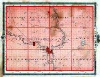 |
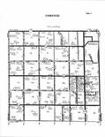
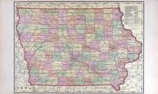
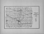
Humboldt County Iowa 1875 State Atlas show address on this map |
A. T. Andreas | 1875 |
 |
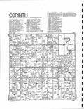
Corinth Township, Humboldt, Dakota City, Bass Lake, Addison P.O. Humboldt County 1896 show address on this map |
North West Publishing Co. | 1896 |
 |
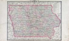
Humboldt County Map Iowa State Atlas 1930c show address on this map |
W.W. Hixson & Co. | 1930 |
 |
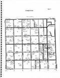
Corinth Humboldt County 1978 show address on this map |
Title Atlas Company | 1978 |
 |
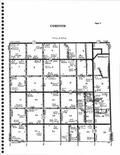
Corinth T91N-R29W Humboldt County 1983 show address on this map |
Directory Service Company | 1983 |
 |
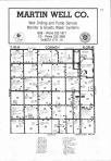
Corinth T91N-R29W Humboldt County 1984 show address on this map |
Directory Service Company | 1984 |
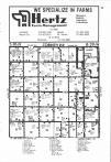 |
Corinth T91N-R29W Humboldt County 1985 show address on this map |
Directory Service Company | 1985 |
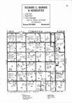 |
Corinth T91N-R29W Humboldt County 1986 show address on this map |
Directory Service Company | 1986 |
 |
Code 10 - Corinth Township, Humboldt Humboldt County 1990 show address on this map |
Title Atlas Company | 1990 |
 |
Corinth T91N-R29W Humboldt County 2002 - 2003 show address on this map |
R. C. Booth Enterprises | 2002 |
 |
Corinth T91N-R29W Humboldt County 2004 - 2005 show address on this map |
R. C. Booth Enterprises | 2004 |
 |
Corinth T91N-R29W Humboldt County 2006 - 2007 show address on this map |
R. C. Booth Enterprises | 2006 |
 |
Corinth T91N-R29W Humboldt County 2008 - 2009 show address on this map |
R. C. Booth Enterprises | 2008 |
 |
Mississippi River 1807 - APSdigobj3545 Mississippi River 1807 show address on this map |
Nav, Anthony; Pike, Zebulon Montgomery, 1779-1813; Thompson; Lewis, M. | 1807 |
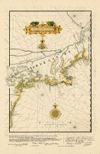 |
Eastern Seaboard Chart 1616 Reprinted in 1841 Virginia to Maine Eastern Seaboard Chart 1616 Reprinted in 1841 Virginia to Maine show address on this map |
Royal Archives of the Hague | 1841 |
 |
British America Wells County 1881 show address on this map |
H.H. Hardesty | 1881 |
 |
United States Map Winnebago County and Boone County 1886 show address on this map |
H. R. Page & Co. | 1886 |
 |
Iowa Rail Road Sectional Map Keokuk County 1887 show address on this map |
C. M. Foote & Co. | 1887 |
 |
Iowa State Map Hardin County 1892 show address on this map |
North West Publishing Co. | 1892 |
 |
Land Survey of the United States Cass County 1893 show address on this map |
D.W. Ensign & Co. | 1893 |
 |
The World Map with Principal Cities of the Old World Fillmore County 1896 show address on this map |
Geo. A. Ogle & Co. | 1896 |
 |
United States Map Genesee County 1899 show address on this map |
Homer A. Day | 1899 |
 |
World Map Rooks County 1904 to 1905 show address on this map |
Geo. A. Ogle & Co. | 1904 |
 |
United States Map Waushara County 1906c show address on this map |
C.A. McIntyre and C.H. Terril | 1906c |
 |
Iowa State Map Buena Vista County 1908 show address on this map |
Geo. A. Ogle & Co. | 1908 |
 |
World Map Guthrie County 1917c show address on this map |
Kenyon Company | 1917c |
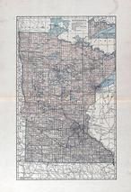 |
Minnesota State Map Yellow Medicine County 1929 show address on this map |
Webb Publishing Co. | 1929 |
 |
Minnesota State Map Big Stone County 1931 show address on this map |
Webb Publishing Co. | 1931 |
 |
Index Map Humboldt County 1948 show address on this map |
Directory Service Company | 1948 |
 |
Iowa State Map Lyon County 1962 show address on this map |
Thomas O. Nelson Co. | 1962 |
 |
Humboldt County Index Map 1 Humboldt and Webster Counties 1985 show address on this map |
Farm and Home Publishers, LTD | 1985 |
 |
Humboldt County Highway Map Kossuth County 1990 show address on this map |
Title Atlas Company | 1990 |