Click on any of the maps below to view a large, zoomable map.
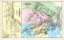 |
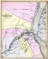
Gardiner 5
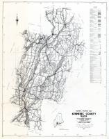
Kennebec County 1879
show address on this map
|
Caldwell & Halfpenny |
1879 |
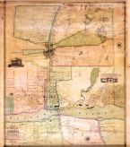 |
Augusta 1851 Wall Map 36x40
Augusta 1851 Wall Map
show address on this map
|
A. G. Gillet |
1851 |
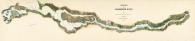 |
Kennebeck River Survey 1870,final,with backing an
Kennebeck River Survey 1870
show address on this map
|
Findlay, Bennett, and Wilson |
1870 |
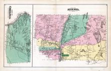 |
Chelsea, Augusta 1
Kennebec County 1879
show address on this map
|
Caldwell & Halfpenny |
1879 |
 |
Town of Gardiner, Farmingdale, Pittston
Maine State Atlas 1884
show address on this map
|
Geo N. Colby & Co. |
1884 |
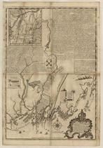 |
Maine 1754 Coast and Rivers MHS Digital Image 2731
Maine 1754 Coast and Rivers MHS Digital Image 2731
show address on this map
|
Thomas Johnston |
1754 |
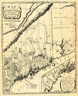 |
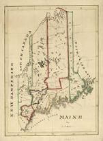
Sullivan's District Map of Maine 1795
Sullivan's District Map of Maine 1795
show address on this map
|
Sullivan |
1795 |
 |
Maine State Map 1799c MHS Digital Image 5103
Maine State Map 1799c MHS Digital Image 5103
show address on this map
|
Osgood Carleton |
1799c |
 |
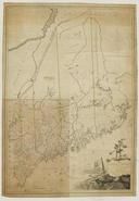
Maine State Map 182x
Maine State Map 182x
show address on this map
|
Perkins, A.T. |
182x |
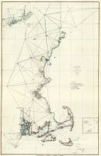 |
Maine to Rhode Island 1851 Coast Survey Chart
Maine to Rhode Island 1851 Coast Survey Chart
show address on this map
|
A. D. Bache Superintendent |
1851 |
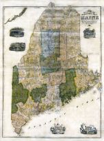 |
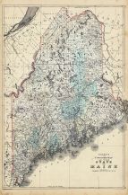
Maine State Map 1855 Wall Map
Maine State Map 1855 Wall Map
show address on this map
|
J. B. Mansfield |
1855 |
 |
New York, New Hampshire, Vermont 1864 Mitchell Plate
New York, New Hampshire, Vermont 1864 Mitchell Plate
show address on this map
|
S. Augustus Mitchell |
1864 |
 |
Maine State Map 1866
Maine State Map 1866
show address on this map
|
A. J. Johnson |
1866 |
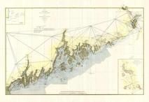 |
Casco Bay to Campobello Island 1879 Coast and Geodetic Survey Section 1 Upper
Casco Bay to Campobello Island 1879 Coast and Geodetic Survey Section 1 Upper
show address on this map
|
Coast and Geodetic Survey |
1879 |
 |
British America
Wells County 1881
show address on this map
|
H.H. Hardesty |
1881 |
 |
St. Croix and Hudson Rivers and Lake Ontario Chart 1882 New England
St. Croix and Hudson River and Lake Ontario Chart 1882 New England
show address on this map
|
U. S. Coastal Survey |
1882 |
 |
New England 1883
New England 1883
show address on this map
|
Van Antwerp Bragg and Co. |
1883 |
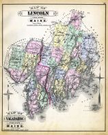 |
Lincoln And Sagadahoc Counties Map
Maine State Atlas 1884
show address on this map
|
Geo N. Colby & Co. |
1884 |
 |
United States Map
Winnebago County and Boone County 1886
show address on this map
|
H. R. Page & Co. |
1886 |
 |
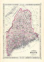
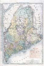
Maine 1887 County and Township Map
Maine 1887 County and Township Map
show address on this map
|
M. Bradley and Bros. |
1887 |
 |
Land Survey of the United States
Cass County 1893
show address on this map
|
D.W. Ensign & Co. |
1893 |
 |
The World Map with Principal Cities of the Old World
Fillmore County 1896
show address on this map
|
Geo. A. Ogle & Co. |
1896 |
 |
United States Map
Genesee County 1899
show address on this map
|
Homer A. Day |
1899 |
 |
World Map
Rooks County 1904 to 1905
show address on this map
|
Geo. A. Ogle & Co. |
1904 |
 |
Maine Railroad Map 1906
Maine Railroad Map 1906
show address on this map
|
Rand-McNally |
1906 |
 |
United States Map
Waushara County 1906c
show address on this map
|
C.A. McIntyre and C.H. Terril |
1906c |
 |
Maine State Map 1908 Revised 1914
Maine State Map 1908 Revised 1914
show address on this map
|
L. L. Poates |
1914 |
 |
World Map
Guthrie County 1917c
show address on this map
|
Kenyon Company |
1917c |
 |
Kennebec County - Section 20 - Pittston, Gardiner, Farmingdale, Chelsea, Windsor, Vassalboro, Sidney, Benton
Maine State Atlas 1961 to 1964 Highway Maps
show address on this map
|
Maine State Highway Commision |
1961 |

 Cart
Cart A variety of printed products can be purchased by clicking on each individual map in the results below.