
 Cart
CartLocation Search results for "Council" in Idaho
Map Matches for "Council" (3) in Idaho
Click on a column header to sort results table.
| Name | Atlas | Publisher | Date | |
|---|---|---|---|---|
 |
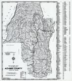
Page 022 - Township 16 N. Range 1 W., Council, Mesa, Vista, Hoover | Adams County 1940 | Metsker Maps | 1940 |
 |
Page 032 - Township 16 N. Range 1 E., Cottonwood Cr., Warm Spring Cr., Council Mtn. | Adams County 1940 | Metsker Maps | 1940 |
 |
Page 042 - Township 16 N. Range 2 E., Weiser River, Council Tri. Sta., Business Can. | Adams County 1940 | Metsker Maps | 1940 |
Atlas Matches for "Council" (0) in Idaho
You may find "Council" in these Idaho atlases:
Click on a column header to sort results table.
| Atlas | Publisher | Date | ||
|---|---|---|---|---|
 |
Adams County 1940 |  |
Metsker Maps | 1940 |
 |
Adams County 1980 to 1996 |  |
Metsker Maps | 1980 |
 |
Valley County 1940 | |
Metsker Maps | 1940 |
 |
Valley County 1980 to 1996 | |
Metsker Maps | 1980 |
 |
Ada County 1938 | |
Metsker Maps | 1938 |
 |
Ada County 1980 to 1996 | |
Metsker Maps | 1980 |
 |
Idaho 1896 State Map |  |
George Franklin | 1896 |
 |
Idaho State Map 1917 | |
L. L. Poates | 1917 |