
 Cart
CartLocation Search results for "Kennebunk" in Maine
Map Matches for "Kennebunk" (9) in Maine
Click on a column header to sort results table.
| Name | Atlas | Publisher | Date | |
|---|---|---|---|---|
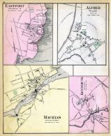 |
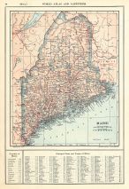
Eastport, Machias, Alfred, Kennebunk | Maine State Atlas 1884 | Geo N. Colby & Co. | 1884 |
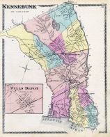 |
Kennebunk, Wells Depot, Kennebunkport | York County 1872 | Sanford, Everts and Co. | 1872 |
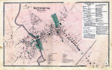 |
Kennebunk Village | York County 1872 | Sanford, Everts and Co. | 1872 |
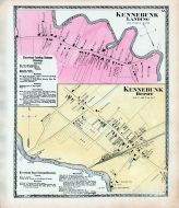 |
Kennebunk Landing, Kennebunk Depot | York County 1872 | Sanford, Everts and Co. | 1872 |
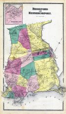 |
Biddeford to Kennebunkport | York County 1872 | Sanford, Everts and Co. | 1872 |
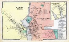 |
Kennebunkport Village,Harbor Village,Cape Porpoise,Goodwin's Mills | York County 1872 | Sanford, Everts and Co. | 1872 |
 |
Kennebunk 1895 Bird's Eye View 17x23 | Kennebunk 1895 Bird's Eye View | George E. Norris | 1895 |
 |
York County, Wells, Kennebunk, South erwick, Kennebunkport, Saco, Biddeford, Waterboro, Limerick | Maine State Atlas 1961 to 1964 Highway Maps | Maine State Highway Commision | 1961 |
 |
York County - Section 54d - Arundel, Biddeford, Saco, Old Orchard, Kennebunk, Kennebunkport, Lyman | Maine State Atlas 1961 to 1964 Highway Maps | Maine State Highway Commision | 1961 |
Atlas Matches for "Kennebunk" (1) in Maine
Click on a column header to sort results table.
| Name | Publisher | Date | ||
|---|---|---|---|---|
|
Kennebunk 1895 Bird's Eye View |  |
George E. Norris | 1895 |
You may find "Kennebunk" in these Maine atlases:
Click on a column header to sort results table.
| Atlas | Publisher | Date | ||
|---|---|---|---|---|
 |
York County 1872 |   |
Sanford, Everts and Co. | 1872 |
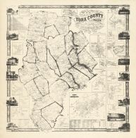 |
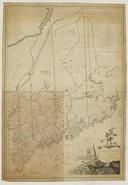
York County 1856 Wall Map |  |
J. L. Smith and Co. | 1856 |
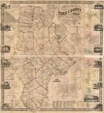 |
York County 1856 Wall Map |  |
J.L. Smith & Co. | 1856 |
 |
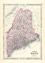
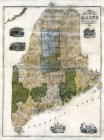
Maine State Atlas 1884 |  |
Geo N. Colby & Co. | 1884 |
 |
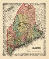
Maine State Map 1860 |  |
Augustus Mitchell Clerk of Court PA | 1860 |
 |
Maine State Map 1866 | |
A. J. Johnson | 1866 |
 |
Maine State Map 1855 | |
Geo. N. Colby | 1855 |
 |
Maine State Map 1908 Revised 1914 | |
L. L. Poates | 1914 |
 |
Maine State Map 1855 Wall Map | |
J. B. Mansfield | 1855 |
 |
Maine State Atlas 1961 to 1964 Highway Maps | |
Maine State Highway Commision | 1961 |
 |
Maine State Map 1799c MHS Digital Image 5103 | |
Osgood Carleton | 1799c |
 |
Maine State Map 182x | |
Perkins, A.T. | 182x |