|
Page 003, Snoqualmie National Forest, Wenatchee National Forest, Thunder Mountain, Lake Clarice, Marmont Lake, Glacier Lake, Deception Lake, Squaro Lake |
Chelan County 1959 |
Metsker Maps |
1959 |
 |
Page 014, Wenatchee National Forest, Mount Stuart, Snow Creek Glacier, Cannon Mountain |
Chelan County 1959 |
Metsker Maps |
1959 |
 |
Page 045 - Boston Glacier, Cascade River, Doubtful Lake, Boston Peak, Horseshoe Basin, Fremont Glacier, Magic Mountain, Middle Fork Cascade River |
Skagit County 1941 |
Chas F. Metsker |
1941 |
 |
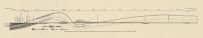
Page 029 - Glacier, Mount Baker National Forest, Gallupp Creek, Davis Creek, Nooksack River |
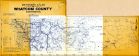
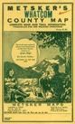
Whatcom County 1942 |
Chas F. Metsker |
1942 |
 |
Page 080 - H.M. Jackson Wilderness, Lost Lake, Twin Peaks, North Fork Sauk River, Spring Mountain, Bingley Gap, Glaciers Peak, Myrtle Lake, Monte Cristo Lake |
Snohomish County 198x |
Chas F. Metsker |
198x |
 |
Page 082 - Suiattle River, Glacier Peak Wilderness, White Chuck Lakes, Gibson Falls |
Snohomish County 198x |
Chas F. Metsker |
198x |
 |
Page 085 - Henry M. Jackson Wilderness, Glacier Peak Wilderness, Hardtack Lake, North Fork Sauk River, Lost Creek, Ruby Lake, Skullcap Peak, Black Mountain |
Snohomish County 198x |
Chas F. Metsker |
198x |
 |
Page 086 - Glacier Peak Wilderness, Lime Ridge, Twin Lakes, White Chuck River, Meadow Lake, Crystal Lake, Owl Creek |
Snohomish County 198x |
Chas F. Metsker |
198x |
 |
Page 087 - Glacier Peak Wilderness, Suiattle River, Box Mountain Lakes, Indigo Lake, Green Mountain Pasture, Captain Creek, Buck Creek, Lime Ridge |
Snohomish County 198x |
Chas F. Metsker |
198x |
 |
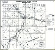
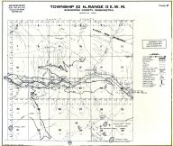
Township 30 N. Range 10 E.W.M., Silverton, Camp Glacier |
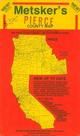
Snohomish County 1927 |
Chas. F. Metsker |
1927 |
 |
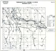
Township 31 N. Range 12 E.W.M., White Chuck River, Glacier Peak Wilderness |
Snohomish County 1975 |
Chas. F. Metsker |
1975 |
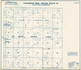 |
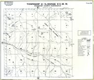
Township 33 N., Range 12 E., Mount Baker national Forest, Glacier Peak Wilderness Area |
Skagit County 1972 |
Metsker Maps |
1972 |
 |
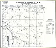
Township 31 N., Range 12 E., Mt. Baker National Forest, Glacier Peak |
Snohomish County 1960c |
Metsker Maps |
1960 |
 |
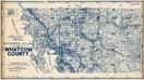
Township 39 N., Range 7 E., Glacier, Nooksack River, Mt. Baker National Forest |
Whatcom County 1971 |
Thos C. Metsker |
1971 |
 |
Page 047 - Township 33 N. Range 12 E., Glacier Peak Wilderness Area, Mt. Buckindy, Horse Cr. |
Skagit County 1996 |
Metsker Maps |
1996 |
 |
Page 082 - Township 32 N., Range 11 E., Glacier Peak Wilderness, Suiattle River, White Chuck Lakes |
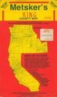
Snohomish County 1992 |
Metsker Maps |
1992 |
 |
Page 086 - Township 31 N., Range 12 E., Glacier Peak Wilderness, Crystal Lake, White Chuck River |
Snohomish County 1992 |
Metsker Maps |
1992 |
 |
Page 087 - Township 32 N., Range 12 E., Glacier Peak Wilderness, Suiattle River, Lime Ridge, Indigo Lake |
Snohomish County 1992 |
Metsker Maps |
1992 |
 |
Page 045 - Township 39 N. Range 7 E., Glacier, Nooksack River, Skyline Divide, Lookout Mtn., Glacier Cr. |
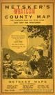
Whatcom County 1983 |
Metsker Maps |
1983 |
 |
Page 049 - Township 38 N. Range 9 E., Smith Cr., Baker Lake, Sulphide Glacier |
Whatcom County 1983 |
Metsker Maps |
1983 |
 |
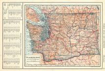
Page 029 - Glacier Township, Nooksack River, Mt. Baker National Forest, Cool Creek |
Whatcom County 1934 Revised and Corrected 1940 and 1947 |
Kroll Map Company |
1934 |

 Cart
Cart