
 Cart
CartAddress Search
Results for "Latitude 38.7315472, Longitude -82.9987134"
View these maps overlayed on top of a modern map. You must be a member and logged in to use this feature.
Purchase a series of maps or images documenting the environmental or land use history of this location.
 A variety of printed products can be purchased by clicking on each individual map in the results below.
Click on any of the maps below to view a large, zoomable map.
 |
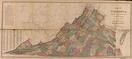
State Map Virginia 1850 State Map show address on this map |
Thomas Cowperthwait | 1850 |
 |
Kentucky 1859 Eastern - APSdigobj3562 Kentucky 1859 Eastern show address on this map |
Lesley, Joseph; Downes, D.; Lesley, J. P. (J. Peter), 1819-1903 | 1859 |
 |
Virginia State Map 1871 Virginia State Map 1871 show address on this map |
N.V. Randolph | 1871 |
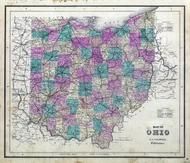 |
Ohio State Map Wayne County 1873 show address on this map |
J. A. Caldwell | 1873 |
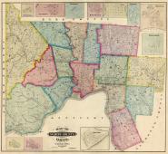 |
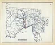
Scioto County 1875 Wall Map 36x39 Scioto County 1875 Wall Map show address on this map |
Barton & Gibbs | 1875 |
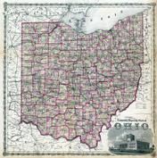 |
Ohio State Map Hocking County 1876 show address on this map |
Titus, Simmons & Titus | 1876 |
 |
Virginia, West Virginia Wells County 1881 show address on this map |
H.H. Hardesty | 1881 |
 |
United States Map Winnebago County and Boone County 1886 show address on this map |
H. R. Page & Co. | 1886 |
 |
Land Survey of the United States Cass County 1893 show address on this map |
D.W. Ensign & Co. | 1893 |
 |
The World Map with Principal Cities of the Old World Fillmore County 1896 show address on this map |
Geo. A. Ogle & Co. | 1896 |
 |
United States Map Genesee County 1899 show address on this map |
Homer A. Day | 1899 |
 |
World Map Rooks County 1904 to 1905 show address on this map |
Geo. A. Ogle & Co. | 1904 |
 |
United States Map Waushara County 1906c show address on this map |
C.A. McIntyre and C.H. Terril | 1906c |
 |
Scioto County Ohio State 1915 Archeological Atlas show address on this map |
Fred J. Heer | 1912 |
 |
World Map Guthrie County 1917c show address on this map |
Kenyon Company | 1917c |