
 Cart
CartAddress Search
Results for "Latitude 38.908277, Longitude -77.040623"
View these maps overlayed on top of a modern map. You must be a member and logged in to use this feature.
Purchase a series of maps or images documenting the environmental or land use history of this location.
 A variety of printed products can be purchased by clicking on each individual map in the results below.
Click on any of the maps below to view a large, zoomable map.
 |
Plate 033 Washington D.C. 1888 Sanborn show address on this map |
Sanborn Map Company | 1888 |
 |
Plate 044 Washington D.C. 1903 Vol 1 Sanborn show address on this map |
Sanborn Map Company | 1903 |
 |
Plate 013 Washington D.C. 1932 Vol 1 show address on this map |
G. W. Baist | 1932 |
 |
Washington D.C. 1792 - APSdigobj3541 Washington D.C. 1792 show address on this map |
Thackara, James, 1767-1848 | 1792 |
 |
Washington D.C. 1792 as drawn in 186x Washington D.C. 1792 as drawn in 186x show address on this map |
Unattributed | 1792c |
 |
Washington D.C. 1857 Wall Map 36x36 Washington D.C. 1857 Wall Map show address on this map |
A. Boschke | 1857 |
 |
Washington D.C. 1861 to 1865 Lines of Defense Wall Map Washington D.C. 1861 to 1865 Lines of Defense Wall Map show address on this map |
Barnard, J. G. 1815-1882 | 1861 |
 |
Washington D.C. 1864 Mitchell Plate Washington D.C. 1864 Mitchell Plate show address on this map |
S. Augustus Mitchell | 1864 |
 |
Washington D.C. 1865 Military Wall Map Washington D.C. 1865 Military Wall Map show address on this map |
United States. War Dept. Engineer Bureau. | 1865 |
 |
Washington D.C. 1877 Washington D.C. 1877 show address on this map |
U. S. Congress Augustus, Mitchell Jr. | 1877 |
 |
Alexandria County, Virginia, Balls X Roads, Arlington, Potomac River Washington D.C. and Montgomery County, MD 1879 show address on this map |
G.M. Hopkins | 1879 |
 |
Potomac River Chart 1882 Washington DC to Georgetown Harbor Potomac River Chart 1882 Washington DC to Georgetown Harbor show address on this map |
Coast Survey Office | 1882 |
 |
Page 007 - Street Lamps Washington D.C. 1891 Engineering Atlas show address on this map |
Rossell, W. T. | 1891 |
 |
Alexandria 1900 Wall Map 44x66 Alexandria 1900 Wall Map show address on this map |
Howell & Taylor | 1900 |
 |
Washington D.C. 1901c Environs of City and Georgetown Washington D.C. 1901c Environs of City and Georgetown show address on this map |
Michler, N. | 1901 |
 |
Virginia and Jamestown 1606 Described by Captain John Smith Engraved by William Hole Virginia and Jamestown 1606 Described by Captain John Smith Engraved by William Hole show address on this map |
William Hole | 1606 |
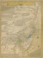 |
Pennsylvania, New Jersey, New York, Delaware 1749 - APSdigobj3524 Pennsylvania, New Jersey, New York, Delaware 1749 show address on this map |
Evans, Lewis, 1700?-1756 | 1749 |
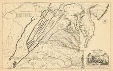 |
Virginia 1755 Map of the Most Inhabited part of Virginia etc Virginia 1755 Map of the Most Inhabited part of Virginia etc Created by Fry and Jefferson in 1751 show address on this map |
Joshua Fry and Peter Jefferson | 1755 |
 |
Pennsylvania 1791c - APSdigobj3529 Pennsylvania 1791c show address on this map |
Adlum, John, 1759-1836; Wallis, John | 1791c |
 |
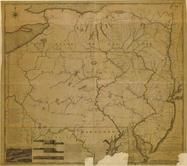
Pennsylvania 1807 including neighboring states - APSdigobj3463 Pennsylvania 1807 including neighboring states show address on this map |
Pursh, Frederick, 1774-1820 | 1807 |
 |
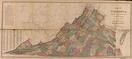
State Map Virginia 1850 State Map show address on this map |
Thomas Cowperthwait | 1850 |
 |
Prince George's County 1861c Wall Map 36x50 Prince George's County 1861c Wall Map show address on this map |
Martenet, Simon J. | 1861 |
 |
Virginia State Map 1871 Virginia State Map 1871 show address on this map |
N.V. Randolph | 1871 |
 |
Maryland, Deleware and District of Columbia Map Washington D.C. and Montgomery County, MD 1879 show address on this map |
G.M. Hopkins | 1879 |
 |
Virginia, West Virginia Wells County 1881 show address on this map |
H.H. Hardesty | 1881 |
 |
United States Map Winnebago County and Boone County 1886 show address on this map |
H. R. Page & Co. | 1886 |
 |
Land Survey of the United States Cass County 1893 show address on this map |
D.W. Ensign & Co. | 1893 |
 |
The World Map with Principal Cities of the Old World Fillmore County 1896 show address on this map |
Geo. A. Ogle & Co. | 1896 |
 |
United States Map Genesee County 1899 show address on this map |
Homer A. Day | 1899 |
 |
World Map Rooks County 1904 to 1905 show address on this map |
Geo. A. Ogle & Co. | 1904 |
 |
United States Map Waushara County 1906c show address on this map |
C.A. McIntyre and C.H. Terril | 1906c |
 |
World Map Guthrie County 1917c show address on this map |
Kenyon Company | 1917c |