
 Cart
CartAddress Search
Results for "Latitude 40.806464, Longitude -96.72077"
View these maps overlayed on top of a modern map. You must be a member and logged in to use this feature.
Purchase a series of maps or images documenting the environmental or land use history of this location.
 A variety of printed products can be purchased by clicking on each individual map in the results below.
Click on any of the maps below to view a large, zoomable map.
 |
West Lincoln and Garfield Lancaster County 1903 show address on this map |
Brown-Scoville Publishing Comany | 1903 |
 |
West Lincoln Township, Garfield Township Lancaster County 1921 show address on this map |
Anderson Publishing Co. | 1921 |
 |
West Lincoln, Garfield T10N-R6E Lancaster County 1988 show address on this map |
Farm and Home Publishers, LTD | 1988 |
 |
West Lincoln, Garfield T10N-R6E Lancaster County 1989 show address on this map |
Farm and Home Publishers, LTD | 1989 |
 |
West Lincoln, Garfield T10N-R6E Lancaster County 1990 show address on this map |
Farm and Home Publishers, LTD | 1990 |
 |
West Lincoln, Garfield T10N-R6E Lancaster County 1991 show address on this map |
Farm and Home Publishers, LTD | 1991 |
 |
West Lincoln, Garfield T10N-R6E Lancaster County 1994 show address on this map |
Farm and Home Publishers, LTD | 1994 |
 |
West Lincoln, Garfield T10N-R6E Lancaster County 1998 show address on this map |
Farm and Home Publishers, LTD | 1998 |
 |
West Lincoln, Garfield T10N-R6E Lancaster County 1999 show address on this map |
Farm and Home Publishers, LTD | 1999 |
 |
West Lincoln, Garfield T10N-R6E Lancaster County 2000 show address on this map |
Farm and Home Publishers, LTD | 2000 |
 |
West Lincoln, Garfield T10N-R6E Lancaster County 2001 show address on this map |
Farm and Home Publishers, LTD | 2001 |
 |
West Lincoln, Garfield T10N-R6E Lancaster County 2002 - 2003 show address on this map |
R. C. Booth Enterprises | 2002 |
 |
West Lincoln, Garfield T10N-R6E Lancaster County 2003 show address on this map |
Farm and Home Publishers, LTD | 2003 |
 |
West Lincoln, Garfield T10N-R6E Lancaster County 2004 show address on this map |
Farm and Home Publishers, LTD | 2004 |
 |
West Lincoln, Garfield T10N-R6E Lancaster County 2005 show address on this map |
Farm and Home Publishers, LTD | 2005 |
 |
West Lincoln, Garfield T10N-R6E Lancaster County 2006 - 2007 show address on this map |
R. C. Booth Enterprises | 2006 |
 |
West Lincoln, Garfield T10N-R6E Lancaster County 2008 - 2009 show address on this map |
R. C. Booth Enterprises | 2008 |
 |
British America Wells County 1881 show address on this map |
H.H. Hardesty | 1881 |
 |
Lancaster County Nebraska State Atlas 1885 show address on this map |
Everts and Kirk | 1885 |
 |
United States Map Winnebago County and Boone County 1886 show address on this map |
H. R. Page & Co. | 1886 |
 |
Iowa Rail Road Sectional Map Keokuk County 1887 show address on this map |
C. M. Foote & Co. | 1887 |
 |
Iowa State Map Hardin County 1892 show address on this map |
North West Publishing Co. | 1892 |
 |
Land Survey of the United States Cass County 1893 show address on this map |
D.W. Ensign & Co. | 1893 |
 |
The World Map with Principal Cities of the Old World Fillmore County 1896 show address on this map |
Geo. A. Ogle & Co. | 1896 |
 |
United States Map Genesee County 1899 show address on this map |
Homer A. Day | 1899 |
 |
County Outline Map Lancaster County 1903 show address on this map |
Brown-Scoville Publishing Comany | 1903 |
 |
World Map Rooks County 1904 to 1905 show address on this map |
Geo. A. Ogle & Co. | 1904 |
 |
United States Map Waushara County 1906c show address on this map |
C.A. McIntyre and C.H. Terril | 1906c |
 |
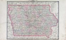
Iowa State Map Buena Vista County 1908 show address on this map |
Geo. A. Ogle & Co. | 1908 |
 |
Missouri State Map Andrew County 1909 show address on this map |
A.R. Stinson | 1909 |
 |
World Map Guthrie County 1917c show address on this map |
Kenyon Company | 1917c |
 |
Topographical Map Lancaster County 1921 show address on this map |
Anderson Publishing Co. | 1921 |
 |
Missouri State Map Missouri State Atlas 1940c show address on this map |
W. W. Hixson & Company | 1940c |
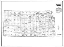 |
Index Map Kansas State Atlas 1958 County Highway Maps show address on this map |
Topographic Land Surveyors | 1958 |
 |
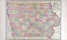
Iowa State Map Lyon County 1962 show address on this map |
Thomas O. Nelson Co. | 1962 |
 |
Nebraska County Map Cass County 1963 Published by Standard Atlas Co show address on this map |
Standard Atlas Co. | 1963 |