Click on any of the maps below to view a large, zoomable map.
 |
Chester East, Pelham & New Rochelle
New York and its Vicinity 1867
show address on this map
|
F. W. Beers, A. D. Ellis & G. C. Soulle |
1867 |
 |
Hempstead North 1 Great Neck Town Roslyn Town
Long Island 1873
show address on this map
|
Beers, Comstock & Cline |
1873 |
 |
Surficial Geology Sheet 002 - New York - New Jersey Harlem Quadrangle
New York City 1902 Geological Atlas of the United States Vol 83
show address on this map
|
U.S. Geological Survey |
1902 |
 |
Port Washington, Sea Cliff, Glen Cove
Nassau County 1906 Long Island
show address on this map
|
E. Belcher-Hyde Map |
1906 |
 |
Sands Point, Center Island and Cove Neck
Nassau County 1914 Long Island
show address on this map
|
E. Belcher-Hyde Map |
1914 |
 |
Plate 001, Great Neck, Port Washington, Glen Cove, Sea Cliff, Little Neck Bay, Manhasset Bay, Hempstead Harbor
Nassau County 1927 Long Island
show address on this map
|
E. Belcher Hyde, Inc. |
1927 |
 |
Plate 001
Nassau County 1939 Long Island
show address on this map
|
Dolph & Stewart |
1939 |
 |
Queens County - Index Map
Queens and Nassau Counties 1946 Long Island
show address on this map
|
Hagstrom Company |
1946 |
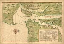 |
New York City 1639 Manatvs gelegen op de Noot Riuier
New York City 1639 Manatvs gelegen op de Noot Riuier
show address on this map
|
Vinckeboons, Joan |
1639 |
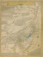 |
Pennsylvania, New Jersey, New York, Delaware 1749 - APSdigobj3524
Pennsylvania, New Jersey, New York, Delaware 1749
show address on this map
|
Evans, Lewis, 1700?-1756 |
1749 |
 |
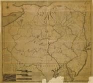
New York Province 1779 Land Tracts new
New York Province 1779 Land Tracts
show address on this map
|
Claude Joseph Sauthier |
1779 |
 |
Pennsylvania 1791c - APSdigobj3529
Pennsylvania 1791c
show address on this map
|
Adlum, John, 1759-1836; Wallis, John |
1791c |
 |
New Jersey 1793 - APSdigobj3457
New Jersey 1793
show address on this map
|
Unattributed |
1793 |
 |
Pennsylvania 1807 including neighboring states - APSdigobj3463
Pennsylvania 1807 including neighboring states
show address on this map
|
Pursh, Frederick, 1774-1820 |
1807 |
 |
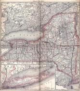
New York, New Hampshire, Vermont 1864 Mitchell Plate
New York, New Hampshire, Vermont 1864 Mitchell Plate
show address on this map
|
S. Augustus Mitchell |
1864 |
 |
State Map - Connecticut Massachusetts Rhode Island
Litchfield County 1874
show address on this map
|
F. W. Beers & Co. |
1874 |
 |
New Jersey State Map
Cumberland County 1876
show address on this map
|
D. J. Stewart |
1876 |
 |
New York, Connecticut
Wells County 1881
show address on this map
|
H.H. Hardesty |
1881 |
 |
St. Croix and Hudson Rivers and Lake Ontario Chart 1882 New England
St. Croix and Hudson River and Lake Ontario Chart 1882 New England
show address on this map
|
U. S. Coastal Survey |
1882 |
 |
New England 1883
New England 1883
show address on this map
|
Van Antwerp Bragg and Co. |
1883 |
 |
United States Map
Winnebago County and Boone County 1886
show address on this map
|
H. R. Page & Co. |
1886 |
 |
Land Survey of the United States
Cass County 1893
show address on this map
|
D.W. Ensign & Co. |
1893 |
 |
The World Map with Principal Cities of the Old World
Fillmore County 1896
show address on this map
|
Geo. A. Ogle & Co. |
1896 |
 |
United States Map
Genesee County 1899
show address on this map
|
Homer A. Day |
1899 |
 |
World Map
Rooks County 1904 to 1905
show address on this map
|
Geo. A. Ogle & Co. |
1904 |
 |
United States Map
Waushara County 1906c
show address on this map
|
C.A. McIntyre and C.H. Terril |
1906c |
 |
World Map
Guthrie County 1917c
show address on this map
|
Kenyon Company |
1917c |
 |
Queens County, Nassau County - Map Pages Index
Queens and Nassau Counties 1946 Long Island
show address on this map
|
Hagstrom Company |
1946 |
 |
Westchester County
New York City 1949 Five Boroughs Street Atlas
show address on this map
|
Hagstrom - Cruikshank Company |
1949 |
 |
Long Island 1xxx - APSdigobj3449
Long Island 1xxx
show address on this map
|
Henry, Mathew Schropp, 1790-1862 |
Unattributed |

 Cart
Cart A variety of printed products can be purchased by clicking on each individual map in the results below.