Click on any of the maps below to view a large, zoomable map.
 |
Chautauqua
Chautauqua County 1881
show address on this map
|
F.W. Beers and Co. |
1881 |
 |
Westfield 001, Barcelona
Chautauqua County 1867
show address on this map
|
William Stewart |
1867 |
 |
Chautauqua Township, Villenova, Hartfield P.O., Mayville, Dewittville, Summerdale
Chautauqua County 1881
show address on this map
|
F.W. Beers and Co. |
1881 |
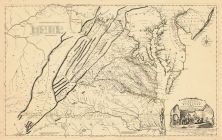 |
Virginia 1755 Map of the Most Inhabited part of Virginia etc
Virginia 1755 Map of the Most Inhabited part of Virginia etc Created by Fry and Jefferson in 1751
show address on this map
|
Joshua Fry and Peter Jefferson |
1755 |
 |
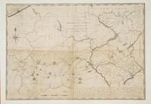
Pennsylvania 1770 - APSdigobj3576
Pennsylvania 1770
show address on this map
|
Scull, William |
1770 |
 |
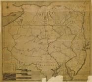
Pennsylvania 1791 - APSdigobj3558
Pennsylvania 1791
show address on this map
|
Howell, Reading, 1743-1827 |
1791 |
 |
Pennsylvania 1791c - APSdigobj3529
Pennsylvania 1791c
show address on this map
|
Adlum, John, 1759-1836; Wallis, John |
1791c |
 |
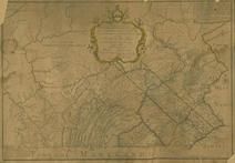
Pennsylvania 1807 including neighboring states - APSdigobj3463
Pennsylvania 1807 including neighboring states
show address on this map
|
Pursh, Frederick, 1774-1820 |
1807 |
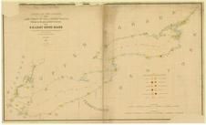 |
Lake Ontario - Lake Erie - Lake Champlain 1861 Lighthouse Charts - APSdigobj3543_001
Lake Ontario - Lake Erie - Lake Champlain 1861 Lighthouse Charts
show address on this map
|
Meade, George Gordon, 1815-1872 |
1861 |
 |
New York, New Hampshire, Vermont 1864 Mitchell Plate
New York, New Hampshire, Vermont 1864 Mitchell Plate
show address on this map
|
S. Augustus Mitchell |
1864 |
 |
Pennsylvania State
Adams County 1872
show address on this map
|
I. W. Field & Company |
1872 |
 |
Chautaugua County 1876
Chautaugua County 1876
show address on this map
|
Grant E. Neil |
1876 |
 |
British America
Wells County 1881
show address on this map
|
H.H. Hardesty |
1881 |
 |
United States Map
Winnebago County and Boone County 1886
show address on this map
|
H. R. Page & Co. |
1886 |
 |
Land Survey of the United States
Cass County 1893
show address on this map
|
D.W. Ensign & Co. |
1893 |
 |
The World Map with Principal Cities of the Old World
Fillmore County 1896
show address on this map
|
Geo. A. Ogle & Co. |
1896 |
 |
United States Map
Genesee County 1899
show address on this map
|
Homer A. Day |
1899 |
 |
World Map
Rooks County 1904 to 1905
show address on this map
|
Geo. A. Ogle & Co. |
1904 |
 |
United States Map
Waushara County 1906c
show address on this map
|
C.A. McIntyre and C.H. Terril |
1906c |
 |
World Map
Guthrie County 1917c
show address on this map
|
Kenyon Company |
1917c |

 Cart
Cart A variety of printed products can be purchased by clicking on each individual map in the results below.