Click on any of the maps below to view a large, zoomable map.
 |
Sunderland, Leverett, Sunderland Village, Leverett Center, Leverett South, South Leverett, Leverett North, North Leverett
Franklin County 1871
show address on this map
|
F. W. Beers & Co. |
1871 |
 |
Plate 023, Franklin, Hampshire, Hampden, Windsor, Deerfield, South Hadley, Becket
Massachusetts State Atlas 1891
show address on this map
|
Geo. H. Walker & Co. |
1891 |
 |
Plate 023 - Cummington, Hadley, West Hampton, Chester, Huntington
Massachusetts State Atlas 1900
show address on this map
|
Geo. H. Walker & Co. |
1900 |
 |
Plate 023 - Chester, Middlefield, Cummington, Plainfield, Windsor, West Hampton
Massachusetts State Atlas 1904
show address on this map
|
Geo. H. Walker & Co. |
1904 |
 |
Plate 023 - Middlefield, Cummington, Plainfield, Deerfield, Southampton, Hadley
Massachusetts State Atlas 1909
show address on this map
|
Walker Lithograph & Publishing Co. |
1909 |
 |
Lake Champlain 1776 MHS Digital Image 2732
Lake Champlain 1776 MHS Digital Image 2732
show address on this map
|
William Brasier |
1776 |
 |
Berkshire County 1777 MHS Digital Image 5089
Berkshire County 1777 MHS Digital Image 5089
show address on this map
|
Wendell family |
1777 |
 |
New York Province 1779 Land Tracts new
New York Province 1779 Land Tracts
show address on this map
|
Claude Joseph Sauthier |
1779 |
 |
Massachusetts 1785c MHS Digital Image 5091
Massachusetts 1785c MHS Digital Image 5091
show address on this map
|
Wendall family |
1785c |
 |
New Hampshire State Map 1794
New Hampshire State Map 1794
show address on this map
|
Samuel Lewis |
1794 |
 |
Massachusetts 1802 MHS Digital Image 2113
Massachusetts 1802 MHS Digital Image 2113
show address on this map
|
Osgood Carleton |
1802 |
 |
Pennsylvania 1807 including neighboring states - APSdigobj3463
Pennsylvania 1807 including neighboring states
show address on this map
|
Pursh, Frederick, 1774-1820 |
1807 |
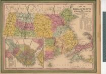 |
Massachusetts and Rhode Island 1850 MHS Digital Image 5155
Massachusetts and Rhode Island 1850 MHS Digital Image 5155
show address on this map
|
Unattributed |
1850 |
 |
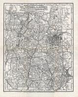
Hampshire County Wall Map 1854
Hampshire County 1854 Wall Map
show address on this map
|
Wm. J. Barker |
1854 |
 |
New York, New Hampshire, Vermont 1864 Mitchell Plate
New York, New Hampshire, Vermont 1864 Mitchell Plate
show address on this map
|
S. Augustus Mitchell |
1864 |
 |
Franklin County Map
Massachusetts State Atlas 1871
show address on this map
|
Stedman, Brown and Lyon |
1871 |
 |
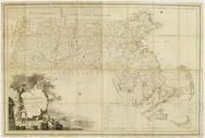
State Map - Connecticut Massachusetts Rhode Island
Litchfield County 1874
show address on this map
|
F. W. Beers & Co. |
1874 |
 |
British America
Wells County 1881
show address on this map
|
H.H. Hardesty |
1881 |
 |
St. Croix and Hudson Rivers and Lake Ontario Chart 1882 New England
St. Croix and Hudson River and Lake Ontario Chart 1882 New England
show address on this map
|
U. S. Coastal Survey |
1882 |
 |
New England 1883
New England 1883
show address on this map
|
Van Antwerp Bragg and Co. |
1883 |
 |
United States Map
Winnebago County and Boone County 1886
show address on this map
|
H. R. Page & Co. |
1886 |
 |
Land Survey of the United States
Cass County 1893
show address on this map
|
D.W. Ensign & Co. |
1893 |
 |
The World Map with Principal Cities of the Old World
Fillmore County 1896
show address on this map
|
Geo. A. Ogle & Co. |
1896 |
 |
United States Map
Genesee County 1899
show address on this map
|
Homer A. Day |
1899 |
 |
New Hampshire and Vermont State Map
New Hampshire and Vermont State Map 1899 Vermont 1902 Directory
show address on this map
|
Matthews-Northrup Co. |
1902 |
 |
World Map
Rooks County 1904 to 1905
show address on this map
|
Geo. A. Ogle & Co. |
1904 |
 |
United States Map
Waushara County 1906c
show address on this map
|
C.A. McIntyre and C.H. Terril |
1906c |
 |
World Map
Guthrie County 1917c
show address on this map
|
Kenyon Company |
1917c |

 Cart
Cart A variety of printed products can be purchased by clicking on each individual map in the results below.