Click on any of the maps below to view a large, zoomable map.
 |
Pepperell 1844
Pepperell 1844
show address on this map
|
J. H. Loring |
1844 |
 |
Groton - Shirley - Pepperell 1847
Groton - Shirley - Pepperell 1847
show address on this map
|
Unattributed |
1847 |
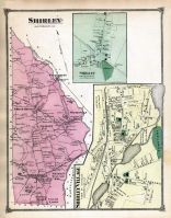 |
Shirley, Shirley Town, Shirley Village
Middlesex County 1875
show address on this map
|
F. W. Beers |
1875 |
 |
Groton 2
Middlesex County 1889
show address on this map
|
Geo. H. Walker & Co. |
1889 |
 |
Plate 018, Worcester, Middlesex, Winchendon, Pepperel, Harvard, Hubbardston
Massachusetts State Atlas 1891
show address on this map
|
Geo. H. Walker & Co. |
1891 |
 |
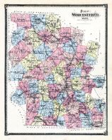
Plate 018 - Princeton, Westminster, Templeton, Hubbardston, Winchendon, Pepperell
Massachusetts State Atlas 1900
show address on this map
|
Geo. H. Walker & Co. |
1900 |
 |
Plate 018 - Hubbardston, Princeton, Leominster, Groton, Shirley
Massachusetts State Atlas 1904
show address on this map
|
Geo. H. Walker & Co. |
1904 |
 |
Plate 018 - Hubbardston, Westminster, Gardner, Winchendon, Ashby, Harvard, Fitchburg
Massachusetts State Atlas 1909
show address on this map
|
Walker Lithograph & Publishing Co. |
1909 |
 |
Lake Champlain 1776 MHS Digital Image 2732
Lake Champlain 1776 MHS Digital Image 2732
show address on this map
|
William Brasier |
1776 |
 |
Vermont 1789 MHS Digital Image 3606
Vermont 1789 MHS Digital Image 3606
show address on this map
|
Amos Doolittle, New Haven, Conn. |
1789 |
 |
New Hampshire State Map 1794
New Hampshire State Map 1794
show address on this map
|
Samuel Lewis |
1794 |
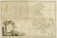 |
Massachusetts 1802 MHS Digital Image 2113
Massachusetts 1802 MHS Digital Image 2113
show address on this map
|
Osgood Carleton |
1802 |
 |
Vermont 1814 State Map 17x21
Vermont 1814 State Map
show address on this map
|
Carey, Mathew |
1814 |
 |
Vermont 181x State Map 17x20
Vermont 181x State Map
show address on this map
|
Doolittle, Amos |
181x |
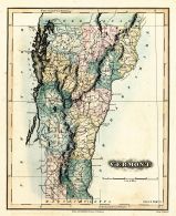 |
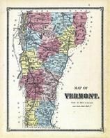
Vermont 1826 State Map 17x20
Vermont 1826 State Map
show address on this map
|
Lucas Fielding |
1826 |
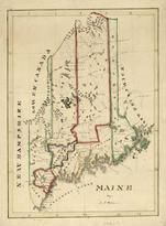 |
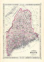
Maine State Map 182x
Maine State Map 182x
show address on this map
|
Perkins, A.T. |
182x |
 |
Middlesex County 1830c MHS Digital Image 4297
Middlesex County 1830c MHS Digital Image 4297
show address on this map
|
James G. Carter |
1830c |
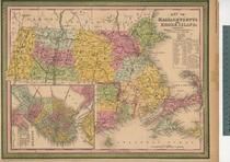 |
Massachusetts and Rhode Island 1850 MHS Digital Image 5155
Massachusetts and Rhode Island 1850 MHS Digital Image 5155
show address on this map
|
Unattributed |
1850 |
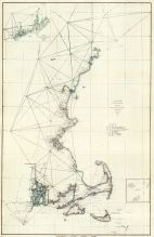 |
Maine to Rhode Island 1851 Coast Survey Chart
Maine to Rhode Island 1851 Coast Survey Chart
show address on this map
|
A. D. Bache Superintendent |
1851 |
 |
Hillsborough County 1858 Wall Map
Hillsborough County 1858 Wall Map
show address on this map
|
Chace, J |
1858 |
 |
New York, New Hampshire, Vermont 1864 Mitchell Plate
New York, New Hampshire, Vermont 1864 Mitchell Plate
show address on this map
|
S. Augustus Mitchell |
1864 |
 |
Maine State Map 1866
Maine State Map 1866
show address on this map
|
A. J. Johnson |
1866 |
 |
Vermont Plan
Windham County 1869
show address on this map
|
F.W. Beers & Co. |
1869 |
 |
Worcester County
Worcester County 1870
show address on this map
|
F. W. Beers & Co. |
1870 |
 |
State Map - Connecticut Massachusetts Rhode Island
Litchfield County 1874
show address on this map
|
F. W. Beers & Co. |
1874 |
 |
British America
Wells County 1881
show address on this map
|
H.H. Hardesty |
1881 |
 |
St. Croix and Hudson Rivers and Lake Ontario Chart 1882 New England
St. Croix and Hudson River and Lake Ontario Chart 1882 New England
show address on this map
|
U. S. Coastal Survey |
1882 |
 |
New England 1883
New England 1883
show address on this map
|
Van Antwerp Bragg and Co. |
1883 |
 |
United States Map
Winnebago County and Boone County 1886
show address on this map
|
H. R. Page & Co. |
1886 |
 |
New Hampshire and Vermont 1880 State Map
New Hampshire and Vermont State Map 1880 Vermont 1888 Directory
show address on this map
|
Wm. P. Northrup and Co. |
1888 |
 |
Middlesex County Map
Middlesex County 1889
show address on this map
|
Geo. H. Walker & Co. |
1889 |
 |
Hillsborough County
New Hampshire State Atlas 1892
show address on this map
|
D. H. Hurd & Co. |
1892 |
 |
Land Survey of the United States
Cass County 1893
show address on this map
|
D.W. Ensign & Co. |
1893 |
 |
The World Map with Principal Cities of the Old World
Fillmore County 1896
show address on this map
|
Geo. A. Ogle & Co. |
1896 |
 |
United States Map
Genesee County 1899
show address on this map
|
Homer A. Day |
1899 |
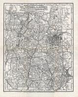 |
New Hampshire and Vermont State Map
New Hampshire and Vermont State Map 1899 Vermont 1902 Directory
show address on this map
|
Matthews-Northrup Co. |
1902 |
 |
World Map
Rooks County 1904 to 1905
show address on this map
|
Geo. A. Ogle & Co. |
1904 |
 |
United States Map
Waushara County 1906c
show address on this map
|
C.A. McIntyre and C.H. Terril |
1906c |
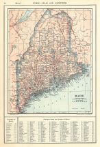 |
Maine State Map 1908 Revised 1914
Maine State Map 1908 Revised 1914
show address on this map
|
L. L. Poates |
1914 |
 |
World Map
Guthrie County 1917c
show address on this map
|
Kenyon Company |
1917c |
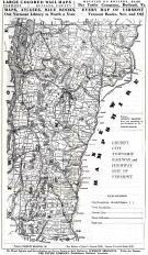 |
Vermont State Map
Vermont State Map 1910c from Vermont 1928 - 1929 Directory
show address on this map
|
Tuttle Company |
1929 |

 Cart
Cart A variety of printed products can be purchased by clicking on each individual map in the results below.