Click on any of the maps below to view a large, zoomable map.
 |
Marietta Township, Mount Sterling, Eastman - Left
Crawford County 1901-1902 Microfilm
show address on this map
|
Geo. A. Ogle & Co. |
1901 |
 |
Marietta Township, Boydtown, Wisconsin River, Steuben
Crawford County 1914
show address on this map
|
Webb Publishing Co. |
1914 |
 |
Marietta Township - West
Crawford County 1930
show address on this map
|
Geo. A. Ogle and Co. |
1930 |
 |
Eastman - East, Marietta - Northwest, Wauzeka - North Central
Crawford County 1980
show address on this map
|
Title Atlas Company |
1980 |
 |
Eastman Township - East, Marietta Township - Northwest, Wauzeka Township - North Central, Steuben
Crawford County 1989
show address on this map
|
Title Atlas Company |
1989 |
 |
Mississippi River 1807 - APSdigobj3545
Mississippi River 1807
show address on this map
|
Nav, Anthony; Pike, Zebulon Montgomery, 1779-1813; Thompson; Lewis, M. |
1807 |
 |
Wisconsin Railroad and Sectional Map
Richland County 1874
show address on this map
|
Harrison & Warner |
1874 |
 |
Grant County Map, Lancaster - Village
Wisconsin State Atlas 1878
show address on this map
|
Snyder, Van, Vetchem & Co. |
1878 |
 |
British America
Wells County 1881
show address on this map
|
H.H. Hardesty |
1881 |
 |
United States Map
Winnebago County and Boone County 1886
show address on this map
|
H. R. Page & Co. |
1886 |
 |
Iowa Rail Road Sectional Map
Keokuk County 1887
show address on this map
|
C. M. Foote & Co. |
1887 |
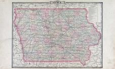 |
Iowa State Map
Hardin County 1892
show address on this map
|
North West Publishing Co. |
1892 |
 |
Land Survey of the United States
Cass County 1893
show address on this map
|
D.W. Ensign & Co. |
1893 |
 |
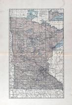
Minnesota State Map
Winona County 1894
show address on this map
|
C. M. Foots & Co. |
1894 |
 |
The World Map with Principal Cities of the Old World
Fillmore County 1896
show address on this map
|
Geo. A. Ogle & Co. |
1896 |
 |
United States Map
Genesee County 1899
show address on this map
|
Homer A. Day |
1899 |
 |
Crawford County Outline Map
Crawford County 1901-1902 Microfilm
show address on this map
|
Geo. A. Ogle & Co. |
1901 |
 |
Crawford County Outline Map
Crawford County 1901-1902
show address on this map
|
Geo. A. Ogle & Co. |
1901-1902 |
 |
Minnesota State Map
Polk County 1902
show address on this map
|
Northwest Publishing Co. |
1902 |
 |
World Map
Rooks County 1904 to 1905
show address on this map
|
Geo. A. Ogle & Co. |
1904 |
 |
United States Map
Waushara County 1906c
show address on this map
|
C.A. McIntyre and C.H. Terril |
1906c |
 |
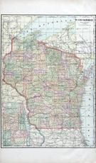
Wisconsin State Map
Pierce County 1908
show address on this map
|
Geo. A. Ogle & Co. |
1908 |
 |
Wisconsin State Map
Fond Du Lac County 1910
show address on this map
|
The Kenyon Company |
1910 |
 |
Wisconsin State Map
Rock County 1917
show address on this map
|
Hennessey & Co. |
1917 |
 |
World Map
Guthrie County 1917c
show address on this map
|
Kenyon Company |
1917c |
 |
Minnesota State Map
Yellow Medicine County 1929
show address on this map
|
Webb Publishing Co. |
1929 |
 |
Index Map
Crawford County 1930
show address on this map
|
Geo. A. Ogle and Co. |
1930 |
 |
Minnesota State Map
Big Stone County 1931
show address on this map
|
Webb Publishing Co. |
1931 |
 |
Crawford County Map
Wisconsin State Atlas 1933c
show address on this map
|
W.W. Hixson & Co. |
1933 |
 |
Minnesota State Map
Pennington and Red Lake Counties 1957
show address on this map
|
K. R. Thompson Co. |
1957 |
 |
Iowa State Map
Lyon County 1962
show address on this map
|
Thomas O. Nelson Co. |
1962 |
 |
Minnesota State Map
McLeod County 1963
show address on this map
|
Thomas O. Nelson Co. |
1963 |

 Cart
Cart A variety of printed products can be purchased by clicking on each individual map in the results below.