Recently Added Images
Below is a list of images that we've recently added to the site.
To see a list for a specific day, click on a calendar day below.
Dates on which images were added are marked in
blue.
Atlas Additions by Date
| November 2012 | | Mon | Tue | Wed | Thu | Fri | Sat | Sun |
|---|
| | 01 | 02 | 03 | 04 |
| 05 | 06 | 07 | 08 | 09 | 10 | 11 |
| 12 | 13 | 14 | 15 | 16 | 17 | 18 |
| 19 | 20 | 21 | 22 | 23 | 24 | 25 |
| 26 | 27 | 28 | 29 | 30 | |
|
| October 2012 | | Mon | Tue | Wed | Thu | Fri | Sat | Sun |
|---|
| 01 | 02 | 03 | 04 | 05 | 06 | 07 |
| 08 | 09 | 10 | 11 | 12 | 13 | 14 |
| 15 | 16 | 17 | 18 | 19 | 20 | 21 |
| 22 | 23 | 24 | 25 | 26 | 27 | 28 |
| 29 | 30 | 31 | |
|
| September 2012 | | Mon | Tue | Wed | Thu | Fri | Sat | Sun |
|---|
| | 01 | 02 |
| 03 | 04 | 05 | 06 | 07 | 08 | 09 |
| 10 | 11 | 12 | 13 | 14 | 15 | 16 |
| 17 | 18 | 19 | 20 | 21 | 22 | 23 |
| 24 | 25 | 26 | 27 | 28 | 29 | 30 |
|
| August 2012 | | Mon | Tue | Wed | Thu | Fri | Sat | Sun |
|---|
| | 01 | 02 | 03 | 04 | 05 |
| 06 | 07 | 08 | 09 | 10 | 11 | 12 |
| 13 | 14 | 15 | 16 | 17 | 18 | 19 |
| 20 | 21 | 22 | 23 | 24 | 25 | 26 |
| 27 | 28 | 29 | 30 | 31 | |
|
Images Added on August 6, 2012
(
Click here to see the newest images)
| Date Added | State | | Image Group Name | Publisher |
| 08/06/12 04:05 PM | VA | 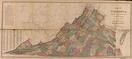 | Virginia State Map 1871 | N.V. Randolph |
| 08/06/12 04:05 PM | VA | 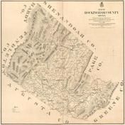 | Rockingham County 1875 Wall Map | Hotchkiss, Jedediah |
| 08/06/12 04:05 PM | VA |  | Richmond 1863 Bird's Eye View | Virtue Yorston & Co. |
| 08/06/12 04:05 PM | VA |  | Prince George, Surry, Sussex and Southhampton County Map 1865 | J.A. Wilson |
| 08/06/12 04:05 PM | VA |  | Prince Edward County 1878 Wall Map | Photo-Litho Co. |
| 08/06/12 04:05 PM | VA |  | Petersburg 189x | Michler, N. |
| 08/06/12 04:05 PM | VA |  | Norfolk and Portsmouth 1851 Wall Map | Rolin & Kelly |
| 08/06/12 04:05 PM | VA |  | Newport News 1862c Bird's Eye View | C.Bohn |
| 08/06/12 04:05 PM | VA |  | Lunenburg County 1871 Wall Map | Unattributed |
| 08/06/12 04:00 PM | VA |  | Henrico County 1901 Wall Map | T. Crawford Redd & Brother |
| 08/06/12 04:00 PM | VA |  | Fauquier County 1876 Wall Map | Garden, H.D. |
| 08/06/12 04:00 PM | VA |  | Chesterfield County 1888 Wall Map | Unattributed |
| 08/06/12 04:00 PM | VA | 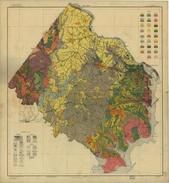 | Alexandria and Fairfax County Soil Map 1915 | Carter, William T. |
| 08/06/12 04:00 PM | VA |  | Albemarle County 1875 Wall Map | Peyton, G. |
| 08/06/12 04:00 PM | ME |  | York County 1856 Wall Map | J.L. Smith & Co. |
| 08/06/12 04:00 PM | ME |  | Waldo County 1859 Wall Map | Chase, J. |
| 08/06/12 03:55 PM | ME |  | Sagadahoc County 1858 Wall Map | Chase, J. |
| 08/06/12 03:55 PM | ME |  | Penobscot Bay and Belfast Bay Chart 1776c | Des Barres, Joseph F.W. |
| 08/06/12 03:55 PM | ME |  | Mount Desert Island and Bar Harbor 1922 | U.S. Geological Survey |
| 08/06/12 03:55 PM | ME |  | Mount Desert Island and Bar Harbor 1776 | Des Barres, Joseph F.W. |
| 08/06/12 03:55 PM | ME |  | Mount Desert Island and Adjacent Islands 1887 | Colby & Stuart |
| 08/06/12 03:55 PM | ME | 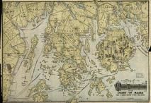 | Mount Desert Island 19xx | Rand Avery, Supply Co. |
| 08/06/12 03:55 PM | ME |  | Mount Desert Island 1917 | Bates, Waldron |
| 08/06/12 03:55 PM | ME |  | Mount Desert Island 1911 | Sherman, W.H. |
| 08/06/12 03:55 PM | ME | 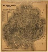 | Mount Desert Island 189x | Eastern Railroad Company |
| 08/06/12 03:55 PM | ME |  | Mount Desert Island 1893 | Rand, Edward L. |
| 08/06/12 03:55 PM | ME |  | Mount Desert Island - Eastern Part 1911 | Bates, Waldron |
| 08/06/12 03:55 PM | ME | 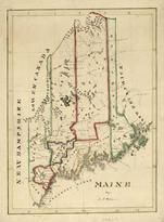 | Maine State Map 182x | Perkins, A.T. |
| 08/06/12 03:55 PM | ME |  | Maine Railroad Map 1899 | Allen, William A. |
| 08/06/12 03:55 PM | ME |  | Lincoln County 1857 Wall Map | Hopkins, Griffith Morgan |
| 08/06/12 03:50 PM | ME |  | Hancock County 1860 Wall Map | Lee & Marsh |
| 08/06/12 03:50 PM | ME |  | Cherryfield 1896 Bird's Eye View | Norris, George E |
| 08/06/12 03:50 PM | ME |  | Casco Bay Chart 1776 | Des Barres, Joseph F.W. |
| 08/06/12 03:50 PM | ME |  | Bar Harbor 1904 | Summer Residents Association |
| 08/06/12 03:50 PM | ME |  | Acadia National Park 1931 | U.S. Geological Survey |

 Cart
Cart