Below is a list of images that we've recently added to the site.
To see a list for a specific day, click on a calendar day below.
| Date Added | State | | Image Group Name | Publisher |
| 09/27/12 09:35 AM | WY | 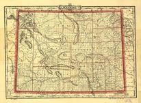 | Wyoming 1895 State Map | Cram, George Franklin |
| 09/27/12 09:35 AM | WA |  | Washington 1866 State Map | Wilson, Joseph S. |
| 09/27/12 09:35 AM | UT |  | Salt Lake County 1890 | Collier & Cleaveland Litho. Co. |
| 09/27/12 09:35 AM | PA |  | Venango County 1865 Oil Regions Map | J.P. Hunt |
| 09/27/12 09:35 AM | PA |  | Union County 1856 | Paschall, Thomas H. |
| 09/27/12 09:35 AM | PA |  | Susquehanna County 1858 | Lee & Marsh Publishers |
| 09/27/12 09:35 AM | PA |  | Schuylkill County 1864 | James D. Scott |
| 09/27/12 09:30 AM | PA |  | Schuylkill County 1863 | James D. Scott |
| 09/27/12 09:30 AM | PA |  | Pike County 1856 | Charles Vinten Lithog. |
| 09/27/12 09:30 AM | PA |  | Pennsylvania 1829 Railroad Map | Anthony Finley |
| 09/27/12 09:30 AM | PA |  | Lehigh County 1862 | G.A. Aschbach |
| 09/27/12 09:30 AM | PA |  | Lawrence and Beaver Counties 1860 | Wm. J. Barker |
| 09/27/12 09:30 AM | PA |  | Lancaster County 1858 | James D. Scott |
| 09/27/12 09:25 AM | PA |  | Lancaster County 1851 | Unattributed |
| 09/27/12 09:25 AM | PA |  | Lancaster County 1842 | Joshua Scott |
| 09/27/12 09:25 AM | PA |  | Fulton County 1873 | A. Pomeroy |
| 09/27/12 09:25 AM | PA | 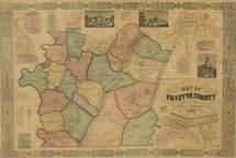 | Fayette County 1858 | Wm. J. Barker |
| 09/27/12 09:25 AM | PA |  | Cambria County 1867 | A. Pomeroy |
| 09/27/12 09:25 AM | PA |  | Berks County 1860 | Friend & Aub |
| 09/27/12 09:25 AM | PA |  | Allegheny County 1898c | Rainey, Chas T. |
| 09/27/12 09:25 AM | OR |  | Yamhill County 1879 | Lawrence & Ogilbe Publishers |
| 09/27/12 09:20 AM | OR |  | Multnomah County 1889 | Habersham, Robert A |
| 09/27/12 09:20 AM | OR |  | Clatsop County 1895 | Astbury, R.C.F. |
| 09/27/12 09:20 AM | OK |  | Oklahoma and Indian Territories 1887 | General Land Office |
| 09/27/12 09:20 AM | OK |  | Cleveland County 1900 | Unattributed |
| 09/27/12 09:20 AM | OH | 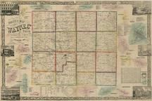 | Wayne County 1856 | Lorey, William |
| 09/27/12 09:20 AM | OH |  | Warren County 1856 | Anthony D. Byles |
| 09/27/12 09:20 AM | OH |  | Trumbull County 1856 | Gillette, Matthews, & Co. |
| 09/27/12 09:20 AM | OH | 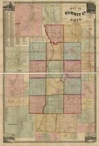 | Summit County 1856 | Paul, Hosea |
| 09/27/12 09:20 AM | OH |  | Stark County 185x | Schuchman, William |
| 09/27/12 09:20 AM | OH |  | Stark County 1855 | Schuchman, William |
| 09/27/12 09:15 AM | OH |  | Shelby County 1865 | Warner, C.S. |
| 09/27/12 09:15 AM | OH |  | Sandusky County 1891 | Hughes, Henry |
| 09/27/12 09:15 AM | OH |  | Morgan County 1854 | Wallace & Co. Lithographers |
| 09/27/12 09:15 AM | OH |  | Montgomery County 1869 | C.O. Titus |
| 09/27/12 09:15 AM | OH |  | Montgomery County 1857 | R.J. Skinner |
| 09/27/12 09:15 AM | OH |  | Monroe County 1869 | Ehrgott, Forbriger & Co. |
| 09/27/12 09:15 AM | OH |  | Miami County 1858 | S.H. Matthews |
| 09/27/12 09:15 AM | OH |  | Medina County 1857 | Matthews and Taintor Publishers |
| 09/27/12 09:10 AM | OH |  | Marion County 1852 | Schuchman & Haunlein |
| 09/27/12 09:10 AM | OH |  | Mahoning County 1860 | Canfield, J.W. |
| 09/27/12 09:10 AM | OH |  | Madison County 1862 | H.F. Walling |
| 09/27/12 09:10 AM | OH |  | Lucas and Part of Wood, Ottawa and Sandusky Counties Map 1888 | Locke & Trowbridge |
| 09/27/12 09:10 AM | OH |  | Licking County 1854 | O'Beirne and W. Boell |
| 09/27/12 09:10 AM | OH |  | Huron County 1859 | A. Krebs & Bros. |
| 09/27/12 09:05 AM | OH |  | Holmes County 1861 | H.F. Walling |
| 09/27/12 09:05 AM | OH | 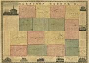 | Harrison County 1862 | Jacob Jarvis |
| 09/27/12 09:05 AM | OH |  | Hancock County 1890c | Hughes Litho. Co. |
| 09/27/12 09:05 AM | OH |  | Hancock County 1863 | Cowles & Titus |
| 09/27/12 09:00 AM | OH |  | Hamilton County 1856 | A.W. Gilbert |
| 09/27/12 09:00 AM | OH |  | Hamilton County 1847 | C.S. Williams & Son |
| 09/27/12 09:00 AM | OH |  | Guernsey County 1855 | Sarony & Co. Lith. |
| 09/27/12 09:00 AM | OH |  | Greene County 1855 | Anthony D. Byles |
| 09/27/12 09:00 AM | OH |  | Geauga and Lake Counties 1857 | |
| 09/27/12 09:00 AM | OH |  | Cuyahoga County 1858 | S.H. Matthews |
| 09/27/12 09:00 AM | OH |  | Crawford County 185x | M.H. and J.V.S. Watson |
| 09/27/12 08:55 AM | OH | 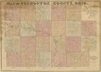 | Coshocton County 185x | M.J. Becker |
| 09/27/12 08:55 AM | OH |  | Columbiana County 1860 | Carhart, Mead & Co. |
| 09/27/12 08:55 AM | OH |  | Clinton County 1858 | H.F. Walling |
| 09/27/12 08:55 AM | OH |  | Clermont County 1857 | Hill, John |
| 09/27/12 08:55 AM | OH |  | Champaign County 1894 | Swisher, James |
| 09/27/12 08:55 AM | OH |  | Champaign County 1858 | Hess, F. |
| 09/27/12 08:55 AM | OH | 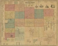 | Auglaize County 18xx | Warner, C.S. |
| 09/27/12 08:55 AM | OH |  | Ashtabula County 1856 | Unattributed |
| 09/27/12 08:55 AM | OH |  | Ashland County 1897 | Niederheiser, F.L. |
| 09/27/12 08:50 AM | OH |  | Ashland County 1861 | Nunan, Philip |
| 09/27/12 08:50 AM | ND |  | Traill County 1900 | Kelly, W.A. |
| 09/27/12 08:50 AM | ND |  | Sargent County 1899 | Herring, John R. |
| 09/27/12 08:50 AM | NM |  | Santa Fe County 1883 | Kingman, E. Jr. |
| 09/27/12 08:50 AM | NV |  | Reno 1907 Bird's Eye View | Brown, Grafton Tyler |
| 09/27/12 08:50 AM | NV |  | Elko County 1894 | McClellan, E.C. |
| 09/27/12 08:50 AM | NE |  | Nebraska 1902c State Map | Cram, George Franklin |
| 09/27/12 08:50 AM | NE | 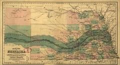 | Nebraska 1879c State Map | Parge, H.R. |
| 09/27/12 08:50 AM | NE |  | Nebraska 1878c State Map | Cram, George Franklin |
| 09/27/12 08:50 AM | NE | 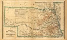 | Nebraska 1876 State Map | G.W. & C.B. Colton & Co. |
| 09/27/12 08:45 AM | NE |  | Nebraska 1874 State Map | Asher & Adams |
| 09/27/12 08:45 AM | MO |  | Missouri 1888 Railway Map | Higgins & Co. |
| 09/27/12 08:45 AM | MO |  | Missouri 1872 State Map | Asher & Adams |
| 09/27/12 08:45 AM | MO |  | Missouri 1861 State Map | Lloyd, James T. |
| 09/27/12 08:45 AM | MN |  | Wright County 1920c | McGIll-Warner Co. |
| 09/27/12 08:45 AM | MN |  | Sherburne County 1913c | Minnesota Map Publishing Co. |
| 09/27/12 08:45 AM | MI | 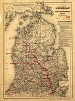 | Michigan 1886 State Map | G.W. & C.B. Colton & Co. |
| 09/27/12 08:45 AM | MI |  | Genesee & Shiawassee 1859 County Map | Geil & Jones |
| 09/27/12 08:45 AM | MI |  | Detroit 1835 City Map | Farmer, John |
| 09/27/12 08:45 AM | KS |  | Kansas 1884 State Map | General Land Office |
| 09/27/12 08:45 AM | KS |  | Kansas 1859 State Map | Mitchell, D.T. |
| 09/27/12 08:45 AM | IA |  | Jefferson County 1871 | Warner, George E. |
| 09/27/12 08:45 AM | IA |  | Jasper County 1871 | Warner, George E. |
| 09/27/12 08:45 AM | IA | 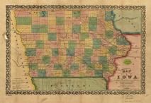 | Iowa 1855 State Map | Mendenhall, Edward |
| 09/27/12 08:40 AM | IN |  | Indiana 1858 State Map | Johnson, A.J. |
| 09/27/12 08:40 AM | IN |  | Indiana 1850 Railroad Map | Morris, Thomas A. |
| 09/27/12 08:40 AM | IN |  | Floyd County 1882 | Smith, George M. |
| 09/27/12 08:40 AM | CO |  | Prowers County 1889 | Trommlitz, George |
| 09/27/12 08:40 AM | CO |  | Leadville 1882 Bird's Eye View | J.J. Stoner |
| 09/27/12 08:40 AM | CO |  | Larimer County 1883 | Handy, H.P. |
| 09/27/12 08:40 AM | CA |  | Sutter County 1873 Wall Map | Pennington, J.T. |
| 09/27/12 08:40 AM | CA |  | Santa Barbara County 1889 Wall Map | Riecker, Paul |
| 09/27/12 08:40 AM | CA |  | San Joaquin County 1895 Wall Map | Compton, H.T. |
| 09/27/12 08:40 AM | CA |  | Plumas County 1892 Wall Map | Keddie, Arthur W. |
| 09/27/12 08:40 AM | CA |  | Orange County 1889 Wall Map | Finley, S.H. |
| 09/27/12 08:35 AM | CA |  | Nevada County 1880 Wall Map | Hartwell, J.G. |
| 09/27/12 08:35 AM | CA |  | Monterey County 1898 Wall Map | W.B. Walkup & Co. |
| 09/27/12 08:35 AM | CA |  | Marin County 1892 Wall Map | Dodge, George M. |
| 09/27/12 08:35 AM | CA |  | Los Angeles County 1898 Wall Map | Wright, E.T. |
| 09/27/12 08:35 AM | CA | 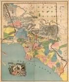 | Los Angeles County 1888 Wall Map Colored | Rowan, V.J. |
| 09/27/12 08:35 AM | CA |  | El Dorado County 1909c | California State Mining Bureau |
| 09/27/12 08:30 AM | CA |  | El Dorado County 1895 Wall Map | Punnett Brothers |
| 09/27/12 08:30 AM | CA |  | Coronado Beach 188x Bird's Eye View | Moore, E.S. |
| 09/27/12 08:30 AM | CA |  | Colusa County 1885 Wall Map | De Jarnatt & Crane |
| 09/27/12 08:30 AM | CA |  | Butte County 1877 Wall Map | McGann, James |
| 09/27/12 08:30 AM | CA |  | Brawley City 1927c | Unattributed |
| 09/27/12 08:30 AM | CA |  | Azusa 1887 Bird's Eye View | Moore, E.S. |
| 09/27/12 08:30 AM | CA |  | Amador County 1866 Wall Map | Griffth, J.M. |

 Cart
Cart