 |
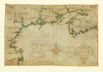
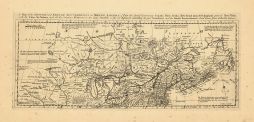
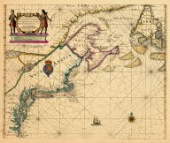
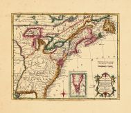
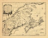
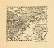
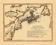
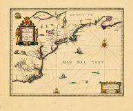
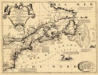
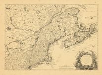
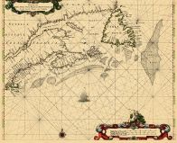
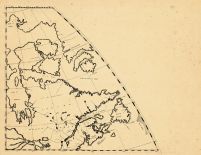
Cape Cod to Nova Scotia 1607 S... |
Cape Cod to Nova Scotia 1607 S... |
 |
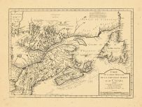
Samuel de Champlain |
1607 |
HMW |
 |
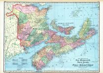
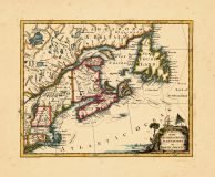
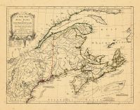
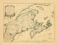
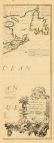
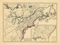
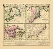
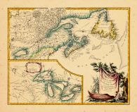
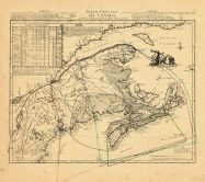
Maritime Provinces |
World Atlas 1913 |
|
Rand McNally and Com... |
1913 |
HMW |
 |
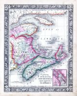
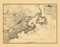
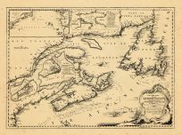
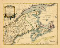
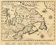
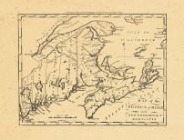
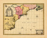
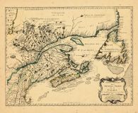
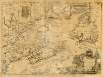
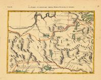
New Brunswick, Nova Scotia, An... |
World Maps 1906 from Wellingto... |
|
Historical Atlas Pub... |
1906 |
HMW |
 |
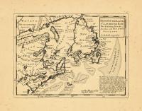
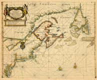
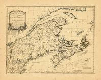
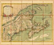
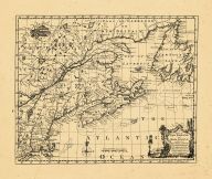
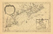
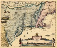
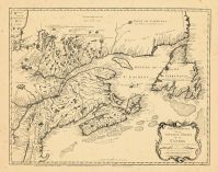
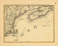
Nova Scotia, New Brunswick, Ca... |
World Atlas 1864 Mitchells New... |
|
S. Augustus Mitchell |
1864 |
HMW |
 |
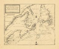
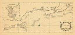
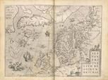
Map - Page 1 |
New Found Land St. Laurence Ba... |
|
Moll, Herman |
1736 |
OML |
|
 |
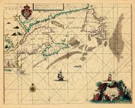
Map - Page 1 - A Chart of the ... |
A Chart of the Coast of/NEW FO... |
|
SELLER, JEREMIAH AND... |
1703 |
OML |
|
 |
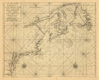
Map - Page 1 - A Chart of the/... |
A Chart of the/Coast of/AMERIC... |
|
SELLER, JOHN |
1675 |
OML |
|
 |
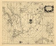
Map - Page 1 - A Chart of the/... |
A Chart of the/Sea Coast of/NE... |
|
THORNTON, JOHN / MOU... |
1713 |
OML |
|
 |
Map - Page 1 - A Chart of ye N... |
A Chart of ye North part of/AM... |
|
THORNTON, JOHN |
1689 |
OML |
|
 |
Map - Page 1 - A Map of the BR... |
A Map of the BRITISH and FRENC... |
|
BOWEN, THOMAS |
1764 |
OML |
|
 |
Map - Page 1 - A MAP/of the/BR... |
A MAP/of the/BRITISH and FRENC... |
|
LONDON MAGAZINE |
1755 |
OML |
|
 |
Map - Page 1 - A NEW AND CORRE... |
A NEW AND CORRECT MAP/OF THE/B... |
|
LAURIE and WHITTLE |
1794 |
OML |
|
 |
Map - Page 1 - A New Chart for... |
A New Chart for the/Seacoasts ... |
|
THORNTON, JOHN/FISHE... |
1687 |
OML |
|
 |
Map - Page 1 - A New Chart of ... |
A New Chart of the Sea Coast o... |
|
THORNTON, JOHN |
1685- |
OML |
|
 |
Map - Page 1 - A New Chart of ... |
A New Chart of the/Coast of/NE... |
|
BELLIN, N. / JEFFERY... |
1746 |
OML |
|
 |
Map - Page 1 - A NEW MAP OF NO... |
A NEW MAP OF NOVA SCOTIA,and C... |
|
JEFFERYS, THOMAS |
1775 |
OML |
|
 |
Map - Page 1 - A NEW MAP OF NO... |
A NEW MAP OF NOVA SCOTIA,and C... |
|
JEFFERYS, THOMAS |
1775 |
OML |
|
 |
Map - Page 1 - A NEW MAP OF NO... |
A NEW MAP OF NOVA SCOTIA,and C... |
|
JEFFERYS, THOMAS |
1775 |
OML |
|
 |
Map - Page 1 - A New MAP of/th... |
A New MAP of/the/BRITISH DOMIN... |
|
ANNUAL REGISTER / KI... |
1763 |
OML |
|
 |
Map - Page 1 - A NEW MAP/of/NO... |
A NEW MAP/of/NOVA SCOTIA/and/C... |
|
JEFFERYS, THOMAS |
1775 |
OML |
|
 |
Map - Page 1 - A NEW MAP/of/NO... |
A NEW MAP/of/NOVA SCOTIA/and/C... |
|
JEFFERYS, THOMAS |
1755 |
OML |
|
 |
Map - Page 1 - A NEW MAP/of/NO... |
A NEW MAP/of/NOVA SCOTIA/and/C... |
|
JEFFERYS, THOMAS |
1775 |
OML |
|
 |
Map - Page 1 - A NEW MAP/of/NO... |
A NEW MAP/of/NOVA SCOTIA/and/C... |
|
JEFFERYS, THOMAS |
1755 [MAY |
OML |
|
 |
Map - Page 1 - A NEW MAP/of/NO... |
A NEW MAP/of/NOVA SCOTIA/and/C... |
|
JEFFERYS, THOMAS |
1755 |
OML |
|
 |
Map - Page 1 - A/Correct Map o... |
A/Correct Map of the Coast/OF/... |
|
SOUTHACK, CYPRIAN |
1731 |
OML |
|
 |
Map - Page 1 - A/MAP of/NEW EN... |
A/MAP of/NEW ENGLAND,/and/NOVA... |
|
LONDON MAGAZINE / KI... |
1758 |
OML |
|
 |
Map - Page 1 - AMERIQUE SEPTEN... |
AMERIQUE SEPTENTRIONALE AVEC L... |
|
MITCHELL, JOHN / LE ... |
1777 |
OML |
|
 |
Map - Page 1 - An/Accurate Map... |
An/Accurate Map/of the/BRITISH... |
|
GENTLEMAN'S MAGAZINE... |
1762 |
OML |
|
 |
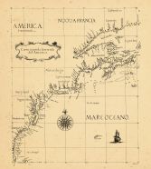
Map - Page 1 - CANADA/ou/NOVVE... |
CANADA/ou/NOVVELLE/FRANCE |
|
MALLET, ALAIN MANESS... |
1686 |
OML |
|
 |
Map - Page 1 - CARTA D'UNA PAR... |
CARTA D'UNA PARTE/DELL'AMERICA... |
|
BELLIN, JACQUES NICO... |
1755- |
OML |
|
 |
Map - Page 1 - Carta Seconda G... |
Carta Seconda Generale/del'Ame... |
|
DUDLEY, ROBERT |
1646 |
OML |
|
 |
Map - Page 1 - CARTE D'UNE PAR... |
CARTE D'UNE PARTIE DE/L'AMERIQ... |
|
BELLIN, JACQUES NICO... |
1756 |
OML |
|
 |
Map - Page 1 - CARTE DES POSSE... |
CARTE DES POSSESSIONS/FRANCOIS... |
|
LONGCHAMPS, [SIEUR S... |
1756 |
OML |
|
 |
Map - Page 1 - Carte geographi... |
Carte geographique de la/Nouel... |
|
CHAMPLAIN, SAMUEL de |
1613 |
OML |
|
 |
Map - Page 1 - CARTE REDUITE D... |
CARTE REDUITE DES/COSTES ORIEN... |
|
BELLIN, JACQUES NICO... |
1757 |
OML |
|
 |
Map - Page 1 - CARTE REDUITE/D... |
CARTE REDUITE/DES COTES ORIENT... |
|
DEPOT GENERAL DES CA... |
1780 |
OML |
|
 |
Map - Page 1 - CARTE/DE LA PAR... |
CARTE/DE LA PARTIE ORIENTALE/D... |
|
BELLIN, JACQUES NICO... |
1744 |
OML |
|
 |
Map - Page 1 - DOMINIA ANGLORU... |
DOMINIA ANGLORUM/in/AMERICA SE... |
|
HOMANN HEIRS/MOLL, H... |
1737- |
OML |
|
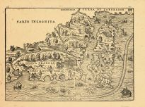 |
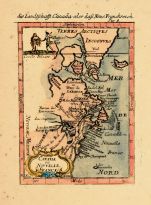
Map - Page 1 - LA NVOVA FRANCI... |
LA NVOVA FRANCIA |
|
RAMUSIO, GIOVANNI B.... |
1606 |
OML |
|
 |
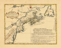
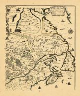
Map - Page 1 - MAP of the DIST... |
MAP of the DISTRICT of MAINE |
|
DOOLITTLE, AMOS |
1796 |
OML |
|
 |
Map - Page 1 - MAPPA/GEOGRAPHI... |
MAPPA/GEOGRAPHICA/AMERICAE/SEP... |
|
EULER, LEONHARD von |
1755 |
OML |
|
 |
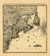
Map - Page 1 - New and Exact M... |
New and Exact MAP of the DOMIN... |
|
MOLL, HERMAN |
1732+ |
OML |
|
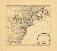 |
Map - Page 1 - NORTH AMERICA F... |
NORTH AMERICA FROM THE FRENCH ... |
|
JEFFERYS, T. / SAYER... |
1775 |
OML |
|
 |
Map - Page 1 - NOUVELLE CARTE ... |
NOUVELLE CARTE PARTICULIERE DE... |
|
POPPLE, HENRY / COVE... |
1741 |
OML |
|
 |
Map - Page 1 - NOVA BELGICA ET... |
NOVA BELGICA ET ANGLIA NOVA |
|
JANSSON, JAN |
1652-58 |
OML |
|
 |
Map - Page 1 - NOVA BELGICA ET... |
NOVA BELGICA ET ANGLIA NOVA |
|
JANSSON, JAN / VALK,... |
1710- |
OML |
|
 |
Map - Page 1 - NOVI BELGII NOV... |
NOVI BELGII NOVAEQUE ANGLIAE/V... |
|
VISSCHER, NICOLAS |
1656- |
OML |
|
 |
Map - Page 1 - PARTIE DE/L'AME... |
PARTIE DE/L'AMERIQUE SEPTENT?/... |
|
VAUGONDY, ROBERT de |
1755 |
OML |
|
 |
Map - Page 1 - PARTIE ORIENTAL... |
PARTIE ORIENTALE DU CANADA |
|
CORONELLI, V.M. / NO... |
1689 |
OML |
|
 |
Map - Page 1 - PARTIE ORIENTAL... |
PARTIE ORIENTALE/DE LA/NOUVELL... |
|
BELLIN, JACQUES NICO... |
1755 |
OML |
|
 |
Map - Page 1 - PARTIE ORIENTAL... |
PARTIE ORIENTALE/DE LA/NOUVELL... |
|
BELLIN, JACQUES NICO... |
1745 |
OML |
|
 |
Map - Page 1 - PARTIE ORIENTAL... |
PARTIE ORIENTALE/DU CANADA/Tra... |
|
JEFFERYS, T. / LE RO... |
1762 |
OML |
|
 |
Map - Page 1 - PARTIE/SEPTENTR... |
PARTIE/SEPTENTRIONALE/Des Poss... |
|
MITCHELL, JOHN / ANO... |
1778 |
OML |
|
 |
Map - Page 1 - Pas caert van/T... |
Pas caert van/TERRA NOVA/Nova ... |
|
COLOM, JACOB AERTSZ. |
1663 |
OML |
|
 |
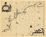
Map - Page 1 - Pas-caerte van/... |
Pas-caerte van/TERRA NOVA,/Nov... |
|
LOON, JOHANNES van |
1666 |
OML |
|
 |
Map - Page 1 - Pascaerte van/N... |
Pascaerte van/NIEV NEDERLANT,/... |
|
JACOBSZ, THEUNIS [LO... |
1681 |
OML |
|
 |
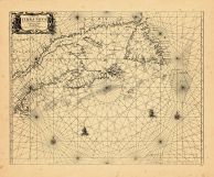
Map - Page 1 - Pascaerte van/T... |
Pascaerte van/TERRA NOVA NOVA ... |
|
ROGGEVEEN, ARENT |
1675 |
OML |
|
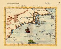 |
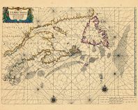
Map - Page 1 - TIERRA NVEVA |
TIERRA NVEVA |
|
RUSCELLI, GIROLAMO /... |
1598-99 |
OML |
|
 |
Map - Page 1 - To his/Excellen... |
To his/Excellency Edwd. Cornwa... |
|
TURNER, JAMES |
1759 |
OML |
|
 |
Map - Page 1 - UNTITLED CHART ... |
UNTITLED CHART OF NOVA SCOTIA ... |
|
NORMAN, JOHN |
1791 |
OML |
|
 |
Map - Page 1 - UNTITLED CHART ... |
UNTITLED CHART OF THE GULF STR... |
|
LE ROUGE, GEORGES-LO... |
1782- |
OML |
|
 |
Map - Page 2 - Le Cours du/MIS... |
Le Cours du/MISSISIPI,/ou de S... |
|
FER, NICOLAS DE |
1718 |
OML |
|
 |
Map - Page 2 - MEXICVM/In hac ... |
MEXICVM/In hac forma in lucem ... |
|
NICOLOSI, GIOVANNI B... |
1660 |
OML |
|
 |
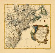
Map - Page 3 - LE COLONIE UNIT... |
LE COLONIE UNITE DELL AMERICA ... |
|
MITCHELL, JOHN / ZAT... |
1778 |
OML |
|
 |
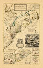
Map - Page 7 - LE COLONIE UNIT... |
LE COLONIE UNITE DELL AMERICA ... |
|
MITCHELL, JOHN / ZAT... |
1778 |
OML |
|
 |
SEPTENTRIONALIVM REGIONVM DESC... |
THEATRUM ORBIS TERRARUM |
|
ORTELIUS, ABRAHAM |
1570 |
OML |
|

 Cart
Cart