Quebec Historical Maps and Atlases
The state of Quebec collection contains 0 atlases spanning 317 years of growth and development (1599 through 1916).
Within the atlases are 0 historical maps, illustrations, and histories many of which contain family names ideal for genealogical research. Others are rare antique maps, part of the collection by an exclusive arrangement with the Osher Map Library. The state of Quebec has 25 of these antiquarian maps dating back as early as 1599.
|
Displaying 1- 9 of 9 in total
|
|
Click on a column header to sort table.
|
Name |
Attributes |
Quality |
Publisher |
State |
Date |
|
Name |
Atlas |
Attributes |
Publisher |
Date |
Collection |
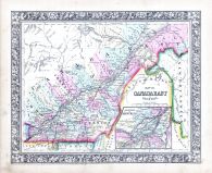 |
Canada East |
World Atlas 1864 Mitchells New... |
|
S. Augustus Mitchell |
1864 |
HMW |
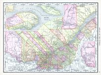 |
Quebec |
World Atlas 1913 |
|
Rand McNally and Com... |
1913 |
HMW |
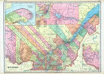 |
Quebec, Montreal |
World Maps 1906 from Wellingto... |
|
Historical Atlas Pub... |
1906 |
HMW |
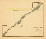 |
Map - Page 1 |
Le Fleuve Saint-Laurent Repres... |
|
Anville, Jean Baptis... |
1763 |
OML |
|
 |
Map - Page 1 |
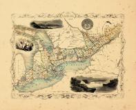
West Canada |
|
J. Tallis & Co. |
1848 |
OML |
|
 |
Map - Page 1 |
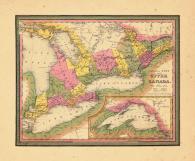
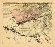
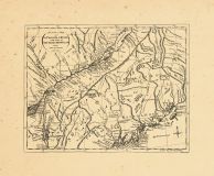
Map of the Country which was t... |
 |
J. Yaeger, engraver |
1822 |
OML |
|
 |
Map - Page 1 |
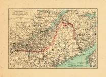
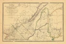
MAP OF THE DISPUTED TERRITORY ... |
|
FEATHERSTONHAUGH and... |
1839 |
OML |
|
 |
Map - Page 1 |
Canada West formerly Upper Can... |
|
S. Augustus Mitchell |
1846 |
OML |
|
 |
Map - Page 1 |
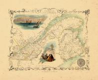
East Canada and New Brunswick |
|
J. Tallis & Co. |
1848 |
OML |
|
 |
Map - Page 1 |
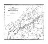
ARRANGEMENT OF/THE BOUNDARY MA... |
|
U.S. GEOLOGICAL SURV... |
1915 |
OML |
|
 |
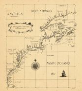
Map - Page 1 - A Chart of ye N... |
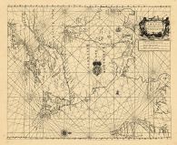
A Chart of ye North part of/AM... |
|
THORNTON, JOHN |
1689 |
OML |
|
 |
Map - Page 1 - A CHOROGRAPHICA... |
A CHOROGRAPHICAL MAP OF THE NO... |
|
ROMANS, BERNARD/COVE... |
1780 |
OML |
|
 |
Map - Page 1 - A New Map/OF TH... |
A New Map/OF THE/PROVINCE OF L... |
|
HOLLAND, SAMUEL / WY... |
1829 [1843] |
OML |
|
 |
Map - Page 1 - A New Map/OF TH... |
A New Map/OF THE/PROVINCE OF L... |
|
HOLLAND, SAMUEL / WY... |
1840 |
OML |
|
 |
Map - Page 1 - A New Map/OF TH... |
A New Map/OF THE/PROVINCE OF L... |
|
HOLLAND, SAMUEL / FA... |
1802 |
OML |
|
 |
Map - Page 1 - An Exact Map/of... |
An Exact Map/of/The PROVINCE o... |
|
LODGE, J. |
1778 |
OML |
|
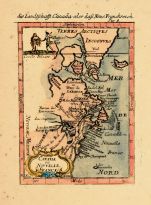 |
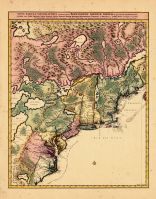
Map - Page 1 - CANADA/ou/NOVVE... |
CANADA/ou/NOVVELLE/FRANCE |
|
MALLET, ALAIN MANESS... |
1686 |
OML |
|
 |
Map - Page 1 - Carta Seconda G... |
Carta Seconda Generale/del'Ame... |
|
DUDLEY, ROBERT |
1646 |
OML |
|
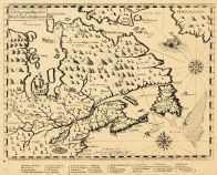 |
Map - Page 1 - Carte geographi... |
Carte geographique de la/Nouel... |
|
CHAMPLAIN, SAMUEL de |
1613 |
OML |
|
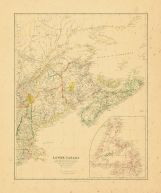 |
Map - Page 1 - LOWER CANADA/NE... |
LOWER CANADA/NEW BRUNSWICK, NO... |
|
ARROWSMITH, JOHN |
1838 |
OML |
|
 |
Map - Page 1 - MAP/of the/VARI... |
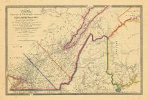
MAP/of the/VARIOUS LINES/BETWE... |
|
GRAHAM, MAJOR JAMES ... |
1846 |
OML |
|
 |
Map - Page 1 - NOVA TABULA GEO... |
NOVA TABULA GEOGRAPHICA COMPLE... |
|
VISSCHER, NICOLAS / ... |
1700- |
OML |
|
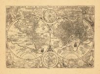 |
Map - Page 1 - ORBIS TERRARUM ... |
ORBIS TERRARUM TYPUS DE INTEGR... |
|
PLANCIUS, PETRUS |
1599 |
OML |
|
 |
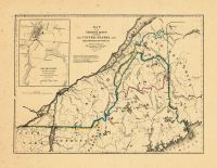
Map - Page 1 - PART OF THE/UNI... |
PART OF THE/UNITED STATES./LOW... |
|
MASON, J[EMIMA] M. |
1840 |
OML |
|
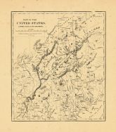 |
Map - Page 1 - PART OF THE/UNI... |
PART OF THE/UNITED STATES./LOW... |
|
MASON, J[EMIMA] M. |
1840 |
OML |
|
|
Displaying 1- 9 of 9 in total
|
|

 Cart
Cart