| Name |
Publisher |
Date |
 Adams, Belleville, Henderson, Mannsville 1947 Telephone Directory
|
Upstate Telephone Corparation of New York |
1947 |
|
|
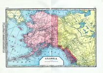
Alaska 1921 Directory and Tour Guide
|
Dynes' Alaska Directory Co. |
1921 |
|
|
Ancestral heads of New England 1620-1700
|
Genealogical Publishing Co. |
1700 |
|
|
Auburn 1945 Directory
|
|
1945 |
|
|
Auburn 1954 Directory
|
R. L. Polk |
1954 |
|
|
Automobile Registration 1949 Vol. 1 Directory
|
Auto List Publishers |
1949 |
|
|
Automobile Registration 1949 Vol. 6 Directory
|
Auto List Publishers |
1949 |
|
|
Automobile Registration 1949 Vol. 7 Directory
|
Auto List Publishers |
1949 |
|
|
Automobile Registration 1949 Vol. 8 Directory
|
Auto List Publishers |
1949 |
|
|
Automobile Registration 1952 Directory
|
Auto List Publishers |
1952 |
|
|
Barnstable and Yarmouth Counties 1901
|
|
1901 |
|
|
Battle Creek 1944 Phone Directory
|
Battle Creek Letter Shop |
1944 |
|
|
Belfast & Camden 1890 Directory
|
Biographical Review Publishing Company |
1890 |
|
|
Bergen - Passaic Counties 1932 Telephone Directory
|
New Jersey Bell Telephone Company |
1932 |
|
|
Beverly 1932 Directory
|
Crowley and Lunt |
1932 |
|
|
Biographical Directory of the State of New York 1900
|
Biographical Directory Company |
1900 |
|
|
Boston 1889 Street Directory
|
Manuel Company |
1889 |
|
|
Boston 1916 Directory of Directors
|
The Bankers Service Company |
1916 |
|
|
Boston Directory
|
|
1871 |
|
|
Boston Directory 1889
|
Sampson, Murdoch and Co. |
1889 |
|
|
Boston Record Commissioners - 1881 - Roxbury Lands and Church Records
|
Rockwell and Churchill |
1881 |
|
|
Boston Record Commissioners 1630 - 1699 Births, Baptisms, Marriages and Deaths
|
William H. Whitemore & William S. Appleton |
1908 |
|
|
Boston Record Commissioners 1674 - 1695 Tax Lists
|
William H. Whitemore & William S. Appleton |
1876 |
|
|
Boston Record Commissioners 1736 - 1742 Selectmens Records
|
William H. Whitemore |
1886 |
|
|
Boston Record Commissioners 1754 - 1763 Selectmens Minutes
|
William H. Whitemore |
1887 |
|
|
Boston Record Commissioners 1758 - 1769 Town Records
|
William H. Whitemore |
1886 |
|
|
Bowdoin Bugle 1948
|
|
1948 |
|
|
Bronx 1945 Telephone Directory
|
New York Telephone Company |
1945 |
|
|
Brooklyn New York City Directory
|
Wm. J. Hearne & James E. Webb |
1848 |
|
|
Brownfield, Denmark, Hiram and Porter 1907 Directory
|
Mitchell, Davis and Daggett |
1907 |
|
|
Buffalo 1915 Telephone Directory
|
Bell Telephone |
1915 |
|
|
Camden & Rockport 1894 Directory
|
A. B. Sparrow |
1894 |
|
|
Cape Cod 1901 Directory
|
A. E. Foss Publishing Co. |
1901 |
|
|
Cape Cod 1950c Resort Directory
|
CC Chambers of Commerce |
1960 |
|
|
CascoBay 1923-1924
|
|
1923 |
|
|
Cayuga County 1936 Directory
|
Rural Directories Inc. |
1936 |
|
|
Colby Oracle 1922
|
The Colby Oracle Associated |
1922 |
|
|
Cranston 1934-35 Directory
|
Sampson &Murdock Co. |
1934 |
|
|
Cranston 1954 Directory
|
R. L. Polk & Co. |
1954 |
|
|
Cumberland County 1896 Biographical Directory
|
Biographical Review Publishing Company |
1896 |
|
|
Dansville and Wayland 190x Directory
|
Vicks Publishing |
190x |
|
|
Dartmouth Alumni 1950 Directory
|
Dartmouth Publications |
1950 |
|
|
Daus New York Blue Book
|
|
1915 |
|
|
Dinghton, Rehoboth, Seekonk, Somerset and Swansea 1951 Directory
|
Eastern Publishing Co. |
1951 |
|
|
Directory of American Society 1930 Vol 2
|
A. R. Keller |
1930 |
|
|
Directory of The New York Academy of Sciences and Affiliated Societies
|
|
1915 |
|
|
Dover and Great Falls Directory 1886
|
|
1886 |
|
|
Dover, Great Falls and Rochester 1878 - 1879 Directory
|
Dean Dudley and Co. |
1879 |
|
|
East Providence 1943 Directory Vol 23
|
R. L. Polk & Co. |
1943 |
|
|
Eastern Cemetery Portland Maine
|
|
1717 |
|
|
Fairbanks 1951 Telephone Directory
|
Fairbanks Municipal Utilities |
1951 |
|
|
Falmouth, Cumberland, Chebeague Island, Yarmouth, North Yarmouth and Freeport 1906 Directory
|
|
1906 |
|
|
Franklin County 1898 Directory
|
Turners |
1898 |
|
|
Gazetteer of Orange County 1762 - 1888
|
Hamilton Child |
1762 |
|
|
Gazetter of Massachusetts 1849
|
|
1849 |
|
|
Gloversville & Johnstown 1909 Directory
|
|
1909 |
|
|
Gorham and Buxton 1905 Town Register
|
Mitchell, Daggett and Bassett |
1905 |
|
|
Grand Rapids 1952 Telephone Directory
|
Michigan Bell Telephone Company |
1952 |
|
|
Green and White Gorham Normal School 1932
|
Gorham Senior Class |
1932 |
|
|
Green and White Gorham Normal School 1939
|
|
1939 |
|
|
Green and White Gorham Normal School 1940
|
|
1940 |
|
|
Green and White Gorham Normal School 1942
|
|
1942 |
|
|
Greenwood Cemetery - Brooklyn 1857 Directory
|
Snyder, Black & Sturn Lith. |
1857 |
|
|
Hartford City 1879 Directory
|
Elihu Geer |
1879 |
|
|
Hartford City 1879 Directory
|
Elihu Geer |
1879 |
|
|
Hartford City 1906 Directory
|
The Hartford Printing Company |
1906 |
|
|
Harwich, Dennis and Chatham 1901 Directory
|
A. E. Foss Publishing Co. |
1901 |
|
|
Houlton, Presque Isle, Fort Fairfield, and Caribou 1900 Directory
|
|
1900 |
|
|
Ithaca 1936 Telephone Directory
|
New York Telephone Company |
1936 |
|
|
Kingfield 1902 Directory
|
H. E. Mitchell |
1902 |
|
|
Kips Bay Farm 1894
|
S. Victor Constant |
1894 |
|
|
Lancaster - Glenbrook District 1934 Telephone Directory
|
New England Telephone |
1934 |
|
|
Lawrence 1900 Directory
|
|
1900 |
|
|
Lawrence County 1925 Directory
|
Louis B. McAnaney |
1925 |
|
|
Lewiston and Auburn 1891 Directory
|
|
1891 |
|
|
Livingston County 1868 Directory
|
|
1868 |
|
|
Long Island 1888 Directory
|
T. H. Todd |
1888 |
|
|
Maine 1896 Biographical Directory
|
Richard Herndon |
1896 |
|
|
Manchester 1941 Telephone Directory
|
New England Telephone & Telegraph Company |
1941 |
|
|
Mayfair 1950 Telephone Directory
|
Michigan Bell Telephone |
1950 |
|
|
Melrose 1958 Directory
|
|
1958 |
|
|
Monroe County 1885 Directory
|
|
1885 |
|
|
Montgomery and Fulton Counties 1869-70 Directory
|
Hamilton Child |
1869 |
|
|
Municipal Index & Atlas 1941
|
American City Magazine |
1941 |
|
|
Musicians Protective Union 1903 - 1904
|
American Federation of Musicians |
1904 |
|
|
Musicians Union Local 802 1932 Directory
|
Associated Musicians of Greater New York |
1932 |
|
|
Nassau County Telephone Directory 1954
|
New York Telephone Co. |
1954 |
|
|
New Portland 1902 Register
|
H. E. Mitchell |
1902 |
|
|
New Vineyard and Strong 1902 Directory
|
H. E. Mitchell and E. K. Woodard |
1902 |
|
|
New York 1877 Manhattan Tutle Farm Titles
|
The Spectator Co. |
1877 |
|
|
New York and Harlem 1891 Railroad Directory
|
|
1891 |
|
|
New York City 1878 Manhattan Tuttle Farm Titles
|
Tuttle H. Croswell |
1878 |
|
|
New York City 1881 Manhattan Tuttle Farm Titles
|
Tuttle H. Croswell |
1881 |
|
|
New York City Directory
|
|
1852 |
|
|
New York City Titles, East of the Commons 1877
|
Tuttle H. Croswell |
1877 |
|
|
Newburgh Bay and Hudson River 1889 Directory
|
Boyd's Directory Corps. |
1889 |
|
|
Old Kittery and Her Families 1903
|
Lewiston Journal |
1903 |
|
|
Orlean, Allegany, Hinsdale, Portville 1955 Telephone Directory
|
New York Telephone Company |
1955 |
|
|
Parsonsfield 1888 Directory
|
Brown Thurston and Company |
1888 |
|
|
Piscataquis County 1907 Directory
|
Newton Journal Publishing Company |
1907 |
|
|
Polk's Westerly RI and Pawcatuck CT City Directory 1948
|
R. L. Polk and Co. |
1948 |
|
|
Porter 1879 Directory
|
Thomas Moulton |
1879 |
|
|
Portland 1856
|
|
1856 |
|
|
Portland 1866 to 1867 Directory
|
S. B. Beckett |
1866 |
|
|
Portland 1869 Directory
|
B. Thurston and Company |
1869 |
|
|
Portland 1871 Directory
|
B. Thurston and Company |
1871 |
|
|
Portland 1875 Directory
|
B. Thurston & Company |
1875 |
|
|
Portland 1889 Directory Vol. 23
|
|
1889 |
|
|
Portland 1895 Directory Vol 36
|
|
1895 |
|
|
Portland 1904 Directory Vol 45
|
|
1904 |
|
|
Portland 1925 Directory
|
|
1925 |
|
|
Portland 1925 Suburban Directory
|
|
1925 |
|
|
Portland 1936 Directory
|
Fred L. Towers Co. |
1936 |
|
|
Portland 1942 Suburban Directory
|
|
1942 |
|
|
Portland 1944 Directory
|
Fred L. Towers Co. |
1944 |
|
|
Portland 1947 Directory
|
Fred L. Tower Companies |
1947 |
|
|
Portland Directory from Cumberland Atlas 1871
|
F. W. Beers and Co. |
1871 |
|
|
Portland High School Review 1922
|
Students of Portland High School |
1922 |
|
|
Portland Maine City Directory
|
|
1879 |
|
|
Portland Maine City Directory
|
|
1936 |
|
|
Portland Maine City Directory
|
|
1868 |
|
|
Portland Maine City Directory
|
|
1871 |
|
|
Portland Maine City Directory
|
|
1873 |
|
|
Portland Maine City Directory
|
|
1875 |
|
|
Portland Maine City Directory
|
|
1877 |
|
|
Portland Soldiers and Sailors 1884 Directory
|
B. Thurslon & Co. |
1884 |
|
|
Providence 1854 Directory
|
H. H. Brown |
1854 |
|
|
Providence 1879 Directory
|
Sampson, Davenport and Co. |
1879 |
|
|
Providence and Pautuckett 1938 Telephone Directory
|
New England Telephone |
1938 |
|
|
Quincy District 1952 Telephone Directory
|
New England Telephone |
1952 |
|
|
Rutland, West Rutland and Proctor 1960 Directory
|
H. A. Manning and Co. |
1960 |
|
|
Sacadahoc, Lincoln, Knox and Waldo 1897 Biographies
|
Biographical Review Publishing Company |
1897 |
|
|
Salamanca 1936 Telephone Directory
|
New York Telephone Company |
1936 |
|
|
San Angelo 1930 Telephone Directory
|
The San Angelo Telephone Company |
1930 |
|
|
San Angelo 1940 Telephone Directory
|
The San Angelo Telephone Company |
1940 |
|
|
Seneca and Ontario Counties 1888-1889 Directory
|
Boyd's Directory Corps. |
1888 |
|
|
Seymour 1931 Telephone Directory
|
Bell Telephone |
1931 |
|
|
South Portland Headlight 1933
|
Class of 1933 |
1933 |
|
|
Spur 1946 Mission Church High School
|
|
1946 |
|
|
St. Johnsbury 1953 Telephone Directory
|
New England Telephone |
1953 |
|
|
The Elite Directory
|
|
1875 |
|
|
The Headlight South Portland High School 1932
|
Class of 1932 |
1932 |
|
|
The Headlight South Portland High School 1933
|
Class of South Portland 1933 |
1933 |
|
|
The Hillcrest Gorham State Teachers College 1955
|
|
1955 |
|
|
The Pean Exeter Prep Academy 1929
|
News Letter Press |
1929 |
|
|
The Totem Portland High School 1925
|
|
1925 |
|
|
The Totem Portland High School 1926
|
|
1926 |
|
|
The Totem Portland High School 1927
|
|
1927 |
|
|
The Totem Portland High School 1930
|
|
1930 |
|
|
The Totem Portland High School 1936
|
|
1936 |
|
|
The Totem Portland High School 1943
|
Students of Portland High School |
1943 |
|
|
The Umpire 1961 USM Yearbook
|
|
1961 |
|
|
The Umpire 1962 USM Yearbook
|
|
1962 |
|
|
The Umpire 1964 USM Yearbook
|
|
1964 |
|
|
The Umpire 1966 USM Yearbook
|
|
1966 |
|
|
Three Rivers 1944 Directory
|
Luedders' |
1944 |
|
|
Trows New York 1867
|
|
1867 |
|
|
Troy 1881 Directory
|
Sampson, Davenport & Co. |
1881 |
|
|
Utica, New Hartford, New York Mills, Yorkville and Whitesboro 1901 Directory
|
|
1901 |
|
|
Vermont 1870 Directory
|
Claremont Manufacturing Co. |
1870 |
|
|
Vermont 1888 Directory
|
White River Paper Co. |
1888 |
|
|
Vermont 1902 Directory
|
Walton Register Company |
1902 |
|
|
Vermont 1918 Directory
|
The Tuttle Company |
1918 |
|
|
Vermont 1928 - 1929 Directory
|
The Tuttle Company |
1928 |
|
|
Walton Public Schools 1934 - 1935
|
|
1934 |
|
|
Warwick and East Greenwich 1952 Directory
|
J. H. Armstrong and Co. |
1952 |
|
|
Warwick and East Greenwich 1952 Directory
|
J. H. Armstrong and Co. |
1952 |
|
|
Westfield 1949 Directory
|
The Price & Lee Company |
1949 |
|
|
White Mountain 1950 Directory
|
Crowley & Lunt |
1950 |
|
|
Who's Who in Colored America 1950
|
Christian E. Burckel & Associates |
1950 |
|
|
Who's Who in Harlem 1949 - 1950
|
Magazine & Periodical Printing & Publishing Company |
1949 |
|
|
Wooster College 1938 - 1939 Directory
|
YMCA |
1939 |
|
|
Worcester Society of Antiquity 1909
|
Worcester Society |
1909 |
|

 Cart
Cart