 |
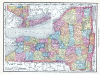
New York |
World Atlas 1913 |
 |
Rand McNally and Com... |
1913 |
HMW |
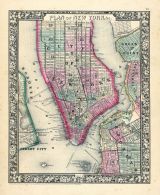 |
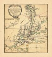
New York, Brooklyn, Manhattan,... |
World Atlas 1864 Mitchells New... |
|
S. Augustus Mitchell |
1864 |
HMW |
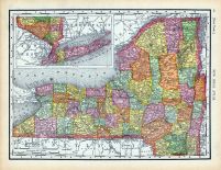 |
Page 066 - New York |
World Atlas 1911c from Minneso... |
|
Rand, McNally and Co... |
1911 |
HMW |
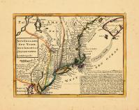 |
Map - Page 1 |
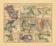
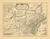
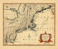
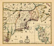
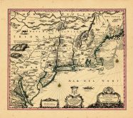
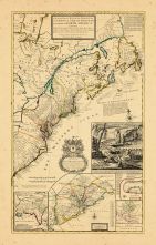
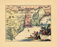
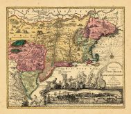
New England, New York, New Jer... |
|
Moll, Herman |
1729 |
OML |
|
 |
Map - Page 1 |
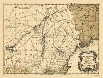
County map of the state of New... |
|
S. Augustus Mitchell... |
1870 |
OML |
|
 |
Map - Page 1 |
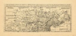
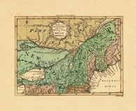
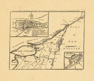
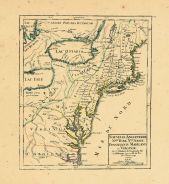
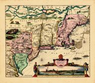
Map of the Country which was t... |
|
J. Yaeger, engraver |
1822 |
OML |
|
 |
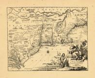
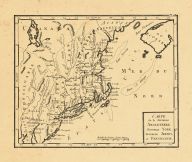
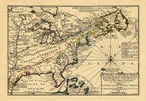
Map - Page 1 |
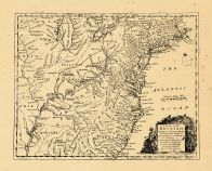
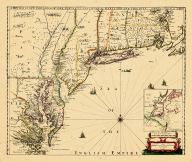
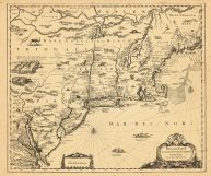
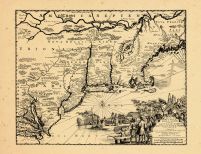
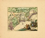
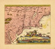
A Map of New England and New Y... |
|
Speed, John |
1676 |
OML |
|
 |
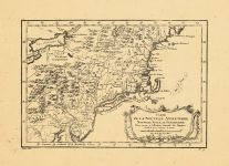
Map - Page 1 |
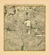
Partie Occidentale de la Nouve... |
|
Bellin, Jacques Nico... |
1755 |
OML |
|
 |
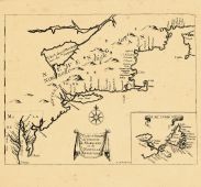
Map - Page 1 |
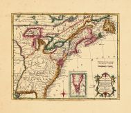
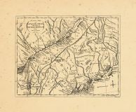
The Seat of Action Between the... |
|
Holland, Samuel |
1776 |
OML |
|
 |
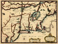
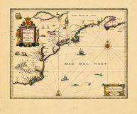
Map - Page 1 |
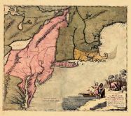
Nova Belgii Quod Nunc Novi Jor... |
|
[Ogilby, John] |
1671 |
OML |
|
 |
Map - Page 1 |
County map of the state of New... |
|
S. Augustus Mitchell |
1867 |
OML |
|
 |
Map - Page 1 |
New York and Brooklyn |
|
S. Augustus Mitchell... |
1870 |
OML |
|
 |
Map - Page 1 |
NOVA ANGLIA/NOVVM BELGIVM/et/V... |
|
JANSSON, JAN |
1639-49 |
OML |
|
 |
Map - Page 1 |
Particular Droughts and Plans ... |
|
Bowen, Emanuel |
1747 |
OML |
|
 |
Map - Page 1 |
Nova Anglia Septentrionali Ame... |
|
Homann, Johann Batis... |
1759 |
OML |
|
 |
Map - Page 1 |
Carte Geographique des Provinc... |
|
Homann Heirs |
1778 |
OML |
|
 |
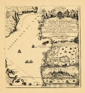
Map - Page 1 - A Chart of the/... |
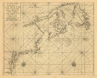
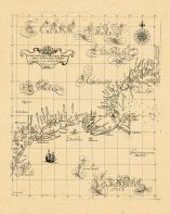
A Chart of the/Sea Coast of/NE... |
|
THORNTON, JOHN / MOU... |
1713 |
OML |
|
 |
Map - Page 1 - A Chart/of the ... |
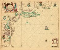
A Chart/of the Sea coasts of/N... |
|
SELLER, JOHN |
1675- |
OML |
|
 |
Map - Page 1 - A CHOROGRAPHICA... |
A CHOROGRAPHICAL MAP OF THE NO... |
|
ROMANS, BERNARD/COVE... |
1780 |
OML |
|
 |
Map - Page 1 - A General/MAP o... |
A General/MAP of the/MIDDLE BR... |
|
EVANS, LEWIS / BOWLE... |
1765- |
OML |
|
 |
Map - Page 1 - A Map of the BR... |
A Map of the BRITISH and FRENC... |
|
BOWEN, THOMAS |
1764 |
OML |
|
 |
Map - Page 1 - A MAP of the/BR... |
A MAP of the/BRITISH/AMERICAN ... |
|
BOWEN, EMANUEL |
1754 |
OML |
|
 |
Map - Page 1 - A Map of/New EN... |
A Map of/New ENGLAND/New YORKE... |
|
MORDEN, ROBERT and B... |
1676 |
OML |
|
 |
Map - Page 1 - A MAP OF/that p... |
A MAP OF/that part of/AMERICA/... |
|
GENTLEMAN'S MAGAZINE |
1757 |
OML |
|
 |
Map - Page 1 - A MAP OF/that p... |
A MAP OF/that part of/AMERICA/... |
|
GENTLEMAN'S MAGAZINE |
1757 |
OML |
|
 |
Map - Page 1 - A MAP OF/that p... |
A MAP OF/that part of/AMERICA/... |
|
GENTLEMAN'S MAGAZINE |
1757 |
OML |
|
 |
Map - Page 1 - A NEW AND CORRE... |
A NEW AND CORRECT MAP/OF THE/B... |
|
LAURIE and WHITTLE |
1794 |
OML |
|
 |
Map - Page 1 - A New and/ACCUR... |
A New and/ACCURATE MAP OF/NEW ... |
|
BOWEN, EMANUEL |
1752 |
OML |
|
 |
Map - Page 1 - A NEW and/ACCUR... |
A NEW and/ACCURATE MAP/of the ... |
|
ROYAL MAGAZINE / ROL... |
1759 |
OML |
|
 |
Map - Page 1 - A NEW MAP OF NE... |
A NEW MAP OF NEW ENGLAND-NEW Y... |
|
THORNTON, JOHN /ROBE... |
1690- |
OML |
|
 |
Map - Page 1 - A New MAP of/th... |
A New MAP of/the/BRITISH DOMIN... |
|
ANNUAL REGISTER / KI... |
1763 |
OML |
|
 |
Map - Page 1 - A NEW MAPP OF/N... |
A NEW MAPP OF/NEW ENGLAND/and/... |
|
BROWNE, C[HRISTOPHER... |
1714 |
OML |
|
 |
Map - Page 1 - A Particular MA... |
A Particular MAP, to Illustrat... |
|
GENTLEMAN'S MAGAZINE... |
1760 |
OML |
|
 |
Map - Page 1 - A/New and Accur... |
A/New and Accurate/MAP/of the ... |
|
UNIVERSAL MAGAZINE /... |
1757 |
OML |
|
 |
Map - Page 1 - An Exact Map/of... |
An Exact Map/of/The PROVINCE o... |
|
LODGE, J. |
1778 |
OML |
|
 |
Map - Page 1 - BELGII NOVI,/AN... |
BELGII NOVI,/ANGLIAE NOVAE, ET... |
|
JANSSON, JAN / SCHEN... |
1694 |
OML |
|
 |
Map - Page 1 - BELGII NOVI,/AN... |
BELGII NOVI,/ANGLIAE NOVAE, ET... |
|
JANSSONIUS, JOANNES |
1651 |
OML |
|
 |
Map - Page 1 - Carta particola... |
Carta particolare della nuoua ... |
|
DUDLEY, ROBERT |
1661 |
OML |
|
 |
Map - Page 1 - CARTE PARTICULI... |
CARTE PARTICULIERE DU FLEUVE S... |
|
CHATELAIN, HENRI A. |
1719 |
OML |
|
 |
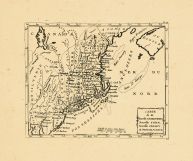
Map - Page 1 - CARTE/DE LA NOU... |
CARTE/DE LA NOUVELLE ANGLETERR... |
|
BELLIN, JACQUES NICO... |
1757 |
OML |
|
 |
Map - Page 1 - CARTE/de la NOU... |
CARTE/de la NOUVELLE/ANGLETERR... |
|
BERTHOLON, C. |
1799 |
OML |
|
 |
Map - Page 1 - CARTE/de la/Nou... |
CARTE/de la/Nouvelle ANGLETERR... |
|
LAPORTE, JOSEPH de |
1781 |
OML |
|
 |
Map - Page 1 - CARTE/DU/THEATR... |
CARTE/DU/THEATRE DE LA GUERRE/... |
|
BRION DE LA TOUR, LO... |
1778 |
OML |
|
 |
Map - Page 1 - Costes et Riuie... |
Costes et Riuieres/de VIRGINIE... |
|
MICHAULT, R. / JUSTE... |
1674 |
OML |
|
 |
Map - Page 1 - LA LOVISIANA,Pa... |
LA LOVISIANA,Parte Settentrion... |
|
CORONELLI, VICENZO M... |
1696 |
OML |
|
 |
Map - Page 1 - LE CANADA,ou NO... |
LE CANADA,ou NOUVELLE FRANCE/R... |
|
FER, NICOLAS de |
1702 |
OML |
|
 |
Map - Page 1 - Le Cours du/MIS... |
Le Cours du/MISSISIPI,/ou de S... |
|
FER, NICOLAS DE |
1718 |
OML |
|
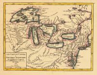 |
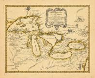
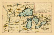
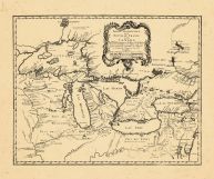
Map - Page 1 - LES LACS DU CAN... |
LES LACS DU CANADA et NOUVELLE... |
|
VAUGONDY, ROBERT de |
1749 |
OML |
|
 |
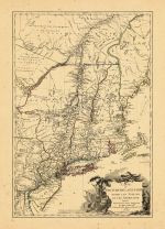
Map - Page 1 - MAP OF NEW ENGL... |
MAP OF NEW ENGLAND AND NEW YOR... |
|
SPEED, JOHN / LAMB, ... |
1676 |
OML |
|
 |
Map - Page 1 - MAPA GEOGRAFICO... |
MAPA GEOGRAFICO/QUE COMPREHEND... |
|
LOPEZ, TOMAS |
1778 |
OML |
|
 |
Map - Page 1 - MAPPA/GEOGRAPHI... |
MAPPA/GEOGRAPHICA/AMERICAE/SEP... |
|
EULER, LEONHARD von |
1755 |
OML |
|
 |
Map - Page 1 - New and Exact M... |
New and Exact MAP of the DOMIN... |
|
MOLL, HERMAN |
1732+ |
OML |
|
 |
Map - Page 1 - NOUVELLE ANGLET... |
NOUVELLE ANGLETERRE/NLLE. YORK... |
|
VAUGONDY, ROBERT de,... |
1749 |
OML |
|
 |
Map - Page 1 - NOUVELLE CARTE ... |
NOUVELLE CARTE PARTICULIERE DE... |
|
POPPLE, HENRY / COVE... |
1741 |
OML |
|
 |
Map - Page 1 - NOUVELLE/HOLLAN... |
NOUVELLE/HOLLANDE,/(a present/... |
|
AA, PIETER VANDER |
1714- |
OML |
|
 |
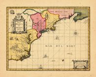
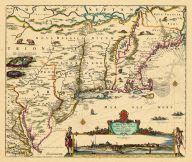
Map - Page 1 - NOVA BELGICA ET... |
NOVA BELGICA ET ANGLIA NOVA |
|
JANSSON, JAN |
1652-58 |
OML |
|
 |
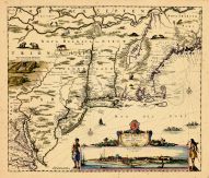
Map - Page 1 - NOVA BELGICA ET... |
NOVA BELGICA ET ANGLIA NOVA |
|
JANSSON, JAN / VALK,... |
1710- |
OML |
|
 |
Map - Page 1 - NOVA TABULA GEO... |
NOVA TABULA GEOGRAPHICA COMPLE... |
|
VISSCHER, NICOLAS / ... |
1700- |
OML |
|
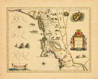 |
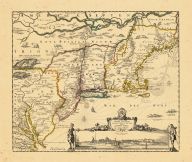
Map - Page 1 - NOVA/BELGICA/ET... |
NOVA/BELGICA/ET/ANGLIA/NOVA |
|
BLAEU, WILLEM |
1638 |
OML |
|
 |
Map - Page 1 - NOVI BELGII NOV... |
NOVI BELGII NOVAEQUE ANGLIAE/P... |
|
VISSCHER, NICOLAS / ... |
1729- |
OML |
|
 |
Map - Page 1 - NOVI BELGII NOV... |
NOVI BELGII NOVAEQUE ANGLIAE/V... |
|
VISSCHER, NICOLAS |
1684 |
OML |
|
 |
Map - Page 1 - NOVI BELGII NOV... |
NOVI BELGII NOVAEQUE ANGLIAE/V... |
|
ALLARD, HUGO |
1662- |
OML |
|
 |
Map - Page 1 - NOVI BELGII NOV... |
NOVI BELGII NOVAEQUE ANGLIAE/V... |
|
VISSCHER, NICOLAS |
1656- |
OML |
|
 |
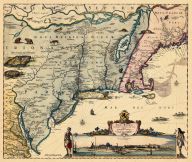
Map - Page 1 - NOVI BELGII,Quo... |
NOVI BELGII,Quod nunc NOVI JOR... |
|
OGILBY, JOHN |
1670 |
OML |
|
 |
Map - Page 1 - NOVI BELGII,Quo... |
NOVI BELGII,Quod nunc NOVI JOR... |
|
OGILBY, JOHN |
1670 |
OML |
|
 |
Map - Page 1 - NOVI BELGII/NOV... |
NOVI BELGII/NOVAEQUE ANGLIAE N... |
|
DANCKERS, JUSTO |
1680- |
OML |
|
 |
Map - Page 1 - NOWEL AMSTERDAM... |
NOWEL AMSTERDAM/EN LAMERIQVE -... |
|
JOLLAIN, [GERARD] [o... |
1672 |
OML |
|
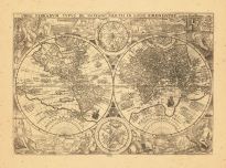 |
Map - Page 1 - ORBIS TERRARUM ... |
ORBIS TERRARUM TYPUS DE INTEGR... |
|
PLANCIUS, PETRUS |
1599 |
OML |
|
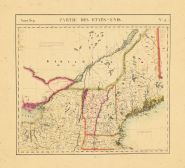 |
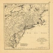
Map - Page 1 - PARTIE DES ETAT... |
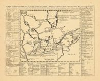
PARTIE DES ETATS-UNIS. No.43. |
|
VANDERMAELEN, PHILIP... |
1827 |
OML |
|
 |
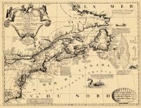
Map - Page 1 - PARTIE OCCIDENT... |
PARTIE OCCIDENTALE/de la/NOUVE... |
|
BELLIN, JACQUES NICO... |
1755 |
OML |
|
 |
Map - Page 1 - PARTIE ORIENTAL... |
PARTIE ORIENTALE DU CANADA |
|
CORONELLI, V.M. / NO... |
1689 |
OML |
|
 |
Map - Page 1 - Pascaerte van/N... |
Pascaerte van/NIEV NEDERLANT,/... |
|
JACOBSZ, THEUNIS [LO... |
1681 |
OML |
|
 |
Map - Page 1 - RECENS EDITA/to... |
RECENS EDITA/totius/NOVI BELGI... |
|
SEUTTER, MATTHAUS / ... |
1762+ |
OML |
|
 |
Map - Page 1 - TOTIUS NEOBELGI... |
TOTIUS NEOBELGII NOVA ET ACCUR... |
|
ALLARD, HUGO / OTTEN... |
1720- |
OML |
|
 |
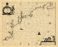
Map - Page 1 - UNTITLED CHART ... |
UNTITLED CHART OF THE GULF STR... |
|
LE ROUGE, GEORGES-LO... |
1782- |
OML |
|
 |
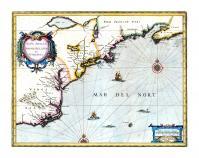
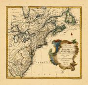
Map - Page 2 - A MAP OF THE/UN... |
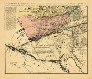
A MAP OF THE/UNITED STATES/of/... |
|
ARROWSMITH, AARON |
1799 |
OML |
|
 |
Map - Page 2 - UNITED STATES o... |
UNITED STATES of Nth. AMERICA/... |
|
TARDIEU, P.F. [AFTER... |
1812 |
OML |
|
 |
Map - Page 4 - Le Cours du/MIS... |
Le Cours du/MISSISIPI,/ou de S... |
|
FER, NICOLAS DE |
1718 |
OML |
|

 Cart
Cart